
IMAGES TAKEN NEAR TO
Turner Road, LICHFIELD, WS14 9GF
Introduction
This page details the photographs taken nearby to Turner Road, WS14 9GF by members of the Geograph project.
The Geograph project started in 2005 with the aim of publishing, organising and preserving representative images for every square kilometre of Great Britain, Ireland and the Isle of Man.

There are currently over 7.5m images from over14,400 individuals and you can help contribute to the project by visiting https://www.geograph.org.uk
Image Map
Images are licensed for reuse under creativecommons.org/licenses/by-sa/2.0
Notes
- Clicking on the map will re-center to the selected point.
- The higher the marker number, the further away the image location is from the centre of the postcode.
Image Listing (5 Images Found)
Images are licensed for reuse under creativecommons.org/licenses/by-sa/2.0
Image
Details
Distance
1
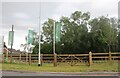
New developments on the Lichfield Southern By-Pass
The road and associated St John's Grange development are not yet visible on Google. https://www.persimmonhomes.com/new-homes/west-midlands/st-john-s-grange
Image: © David Howard
Taken: 19 Jun 2022
0.18 miles
2
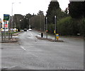
South along the A5206 London Road, Lichfield
This is the northern end of the A5206, a 1 kilometre long road
which ends at the A38 and A5148 junctions. Viewed across the A51.
Image: © Jaggery
Taken: 17 Feb 2018
0.19 miles
3
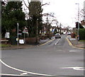
West along Shortbutts Lane, Lichfield
Viewed across the A51 Upper St John Street.
Image: © Jaggery
Taken: 17 Feb 2018
0.22 miles
4
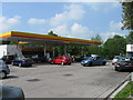
Shell filling station, London Road, Lichfield
Image: © Alex McGregor
Taken: 21 May 2010
0.23 miles
5
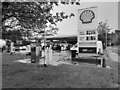
Study of a Gasoline Station
Shell, Lichfield.
This photograph is part of a series taken in homage to the American artist Ed Ruscha's 1963 publication of 'Twentysix Gasoline Stations'.
More properly known as filling stations in the UK, I am attempting to photograph as many as possible to mark the sixty year anniversary.
Image: © David Bremner
Taken: 11 May 2023
0.23 miles