
IMAGES TAKEN NEAR TO
Burns Close, LICHFIELD, WS14 9DW
Introduction
This page details the photographs taken nearby to Burns Close, WS14 9DW by members of the Geograph project.
The Geograph project started in 2005 with the aim of publishing, organising and preserving representative images for every square kilometre of Great Britain, Ireland and the Isle of Man.

There are currently over 7.5m images from over14,400 individuals and you can help contribute to the project by visiting https://www.geograph.org.uk
Image Map
Images are licensed for reuse under creativecommons.org/licenses/by-sa/2.0
Notes
- Clicking on the map will re-center to the selected point.
- The higher the marker number, the further away the image location is from the centre of the postcode.
Image Listing (67 Images Found)
Images are licensed for reuse under creativecommons.org/licenses/by-sa/2.0
Image
Details
Distance
2
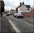
Chapel Lane Lichfield
From the corner of Upper St John Street.
Image: © Jaggery
Taken: 17 Feb 2018
0.10 miles
3
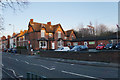
Kingfisher Club
A private members club which was formerly the Conservative Club.
Image: © Bill Boaden
Taken: 27 Dec 2017
0.14 miles
4
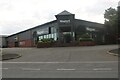
Magnet Kitchens on Birmingham Road, Lichfield
Image: © David Howard
Taken: 19 Jun 2022
0.14 miles
5
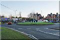
Roundabout on the western side of Lichfield
The western ring road is meeting Birmingham Road.
Image: © Bill Boaden
Taken: 27 Dec 2017
0.14 miles
6
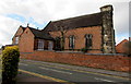
Chapel Lane side of Holy Cross Catholic church, Lichfield
The church on the corner of Upper St John Street is in the Roman Catholic Parish of Holy Cross and Saints Peter & Paul in the Archdiocese of Birmingham. The church was built in 1802-1803, enlarged and refronted in 1834. Grade II listed in 1994. https://www.geograph.org.uk/photo/5691572 to a corner view of the church.
Image: © Jaggery
Taken: 17 Feb 2018
0.16 miles
7

Holy Cross Catholic Church
Holy Cross Catholic Church on Upper St John Street in Lichfield.
Image: © Philip Halling
Taken: 25 Aug 2018
0.17 miles
8

Ordnance Survey bolt on Holy Cross Church
Ordnance Survey bolt on south-east face of small tower on Holy Cross Church. This 19th-century bench mark was established in 1851 during the First primary levelling of England & Wales, and was levelled with a height of 304.6780 feet [92.8659 metres] above mean sea level (Liverpool datum). It was included as a side level on the Sheffield to Birmingham levelling line. The surveyor's description was "No. 222(b). R.C. Chapel, Upper St. John-street. Bolt in East side of small tower ; 1.47 ft. above surface." (p.361)
Image: © Shantavira
Taken: 3 May 2013
0.17 miles
9

Holy Cross Catholic church, Lichfield
The church on the corner of Upper St John Street and Chapel Lane is in the Roman Catholic Parish of Holy Cross and Saints Peter & Paul in the Archdiocese of Birmingham. The church was built in 1802-1803, enlarged and refronted in 1834. Grade II listed in 1994. The presbytery on the right was included in the listing.
Image: © Jaggery
Taken: 17 Feb 2018
0.17 miles
10
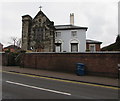
Roman Catholic church and presbytery, Lichfield
Holy Cross Catholic church and presbytery (priests' house) viewed across Upper St John Street, part of the Roman Catholic Archdiocese of Birmingham. The church and presbytery were built in 1802-1803, Grade II listed in 1994. https://www.geograph.org.uk/photo/5691572 to a corner view.
Image: © Jaggery
Taken: 17 Feb 2018
0.17 miles