
IMAGES TAKEN NEAR TO
Belvidere Road, WALSALL, WS1 3AU
Introduction
This page details the photographs taken nearby to Belvidere Road, WS1 3AU by members of the Geograph project.
The Geograph project started in 2005 with the aim of publishing, organising and preserving representative images for every square kilometre of Great Britain, Ireland and the Isle of Man.

There are currently over 7.5m images from over14,400 individuals and you can help contribute to the project by visiting https://www.geograph.org.uk
Image Map
Images are licensed for reuse under creativecommons.org/licenses/by-sa/2.0
Notes
- Clicking on the map will re-center to the selected point.
- The higher the marker number, the further away the image location is from the centre of the postcode.
Image Listing (32 Images Found)
Images are licensed for reuse under creativecommons.org/licenses/by-sa/2.0
Image
Details
Distance
1
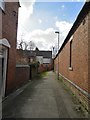
Short alley between Sandymount Road and Belvidere Road, Walsall
The now defunct Highgate Brewery is behind the wall on the right.
Image: © Frank Smith
Taken: 11 Mar 2019
0.01 miles
3
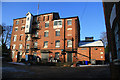
Highgate Brewery, Walsall
Fine tower brewery with the square chimney just visible and a fine set of gates.
Image: © Chris Allen
Taken: 5 Dec 2010
0.03 miles
4
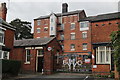
The old Highgate brewery
At one time the Highgate brewery in Walsall brewed only a mild ale, which was amongst the best mild ales brewed anywhere. Sadly, the brewery is now closed.
Image: © Derek Bennett
Taken: 19 Sep 2018
0.03 miles
5
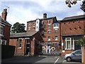
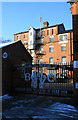
Highgate Brewery
The gates mark the centenary of brewing on this site in 2008.
Image: © John M
Taken: 8 Sep 2012
0.04 miles
6
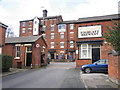
Highgate Brewery, Walsall
They've been brewing beer here since 1899 which is the year that Walsall born Jerome K. Jerome wrote 'Three Men in a Boat'. Highgate Mild is my favourite mild. They also do an Old Ale which is excellent.
Image: © Frank Smith
Taken: 3 Apr 2006
0.04 miles
7
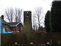
The Old Windmill at Highgate, Walsall
This old mill was built in the early 19th century. Its sails have long gone and the top of it has been altered as can be seen. It was once used as an amateur astronomical observatory and during the last war was manned every night by local air raid wardens as it was the highest point in the area. It can be seen from the top of Highgate Road which used to be called Windmill Lane. The area is generally known as 'The Windmill'.
Image: © Frank Smith
Taken: 8 Mar 2006
0.10 miles
8
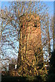
Highgate Windmill, Walsall
A long derelict tower mill that is largely obscured by trees from any direction.
It took a good long time to find this and the locals we asked were largely clueless. Eventually it was a case of spotting it by looking in a direction we didn't expect to see it in when we were on the point of throwing in the towel.
Image: © Chris Allen
Taken: 5 Dec 2010
0.10 miles
9
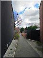
Short alleyway between Emery Street and Jesson Road, Walsall
Image: © Frank Smith
Taken: 11 Mar 2019
0.11 miles
10
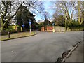
Junction of Highgate Avenue and Highgate Road, Walsall
Image: © Frank Smith
Taken: 4 Mar 2019
0.12 miles