
IMAGES TAKEN NEAR TO
Friars Alley, LICHFIELD, WS13 6QB
Introduction
This page details the photographs taken nearby to Friars Alley, WS13 6QB by members of the Geograph project.
The Geograph project started in 2005 with the aim of publishing, organising and preserving representative images for every square kilometre of Great Britain, Ireland and the Isle of Man.

There are currently over 7.5m images from over14,400 individuals and you can help contribute to the project by visiting https://www.geograph.org.uk
Image Map
Images are licensed for reuse under creativecommons.org/licenses/by-sa/2.0
Notes
- Clicking on the map will re-center to the selected point.
- The higher the marker number, the further away the image location is from the centre of the postcode.
Image Listing (647 Images Found)
Images are licensed for reuse under creativecommons.org/licenses/by-sa/2.0
Image
Details
Distance
1

Friar's Alley
The Lichfield Alley heads towards Bird Street with St Mary's Spire on the skyline.
Image: © Gordon Griffiths
Taken: 11 May 2010
0.03 miles
2

Soda Street, Lichfield
A quick bite to eat.
Image: © Kenneth Allen
Taken: 12 Apr 2007
0.03 miles
3

Site of Franciscan Friary
Lichfield's Franciscan Friary was founded during the reign of Henry III in 1237. After just over three centuries the Friary was dissolved by Henry VIII in 1538. In the early 20th century the site was threatened with development. An archaeological excavation took place here in 1933 and revealed the extent and the ruins. As a result it became a Scheduled Ancient Monument and thus protecting the site from development.
Image: © Philip Halling
Taken: 7 Feb 2020
0.04 miles
4

Lichfield Franciscan Friary
Part of the remains of the Franciscan Friary in Lichfield. The Friary was closed in 1538 by Henry VIII.
Image: © Philip Halling
Taken: 7 Feb 2020
0.04 miles
5
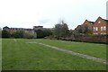
Site of the Franciscan Friary
Founded in 1237 and survived until the abolition by Henry VIII in 1538.
Image: © DS Pugh
Taken: 11 Mar 2023
0.04 miles
6

Lichfield Telephone Exchange (1)
Situated in The Friary WS13 6QE, this redbrick building dates from 1938 and has the code CMLIC. It provides telephone and broadband services to approximately 14,190 residential and 845 non-residential premises in Lichfield plus Curborough and Elmhurst nearby. The extension to the TE is to the left of the photo, having been added more recently.
Image: © David Hillas
Taken: 11 Mar 2023
0.04 miles
7

The Bishop's Lodging House
This elderly building is attached to the much more modern Image, and dates possibly from as early as the 13th century, albeit with several changes, alterations and patching over the years. At least one gravestone of 14th century vintage (possibly older) is incorporated into one of the walls, and a datestone of 1746 can be found in the entrance archway. It's included within the Grade II listing https://britishlistedbuildings.co.uk/101194881-lichfield-college-and-lichfield-library-lichfield#.Ys7CsnbMI2w & https://historicengland.org.uk/listing/the-list/list-entry/1194881 that was awarded to the newer library/college building in the 1950s.
Image: © Richard Law
Taken: 28 Apr 2022
0.05 miles
8

Path Located along the (A51) The Friary (1)
This photograph Image shows a view of the (A51)
Image: © Chris' Buet
Taken: 20 Jun 2010
0.05 miles
9

Path located along the (A51) The Friary (2)
This photograph Image shows another view of this path.
Image: © Chris' Buet
Taken: 20 Jun 2010
0.05 miles
10
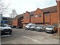
Lichfield Telephone Exchange (2)
This photo shows the extension to the TE with Openreach vehicles parked in front of it. Lichfield TE is the main one of eleven in the (01543) group. These are pictured at https://telephone-exchanges.org.uk/exchanges/lichfield-exchanges/. To the left of the photo can be seen The Friary multi-storey car park.
Image: © David Hillas
Taken: 11 Mar 2023
0.05 miles