
IMAGES TAKEN NEAR TO
Hawthorn Close, LICHFIELD, WS13 6HG
Introduction
This page details the photographs taken nearby to Hawthorn Close, WS13 6HG by members of the Geograph project.
The Geograph project started in 2005 with the aim of publishing, organising and preserving representative images for every square kilometre of Great Britain, Ireland and the Isle of Man.

There are currently over 7.5m images from over14,400 individuals and you can help contribute to the project by visiting https://www.geograph.org.uk
Image Map
Images are licensed for reuse under creativecommons.org/licenses/by-sa/2.0
Notes
- Clicking on the map will re-center to the selected point.
- The higher the marker number, the further away the image location is from the centre of the postcode.
Image Listing (24 Images Found)
Images are licensed for reuse under creativecommons.org/licenses/by-sa/2.0
Image
Details
Distance
1

Samuel Johnson Hospital (4)
One of the original workhouse buildings from 1840 by George Gilbert Scott and William Moffatt, this gatehouse is grade II listed (list entry 1218929).
Image: © Stephen Craven
Taken: 11 Mar 2023
0.09 miles
2

Samuel Johnson Hospital (3)
One of the original workhouse buildings from 1840 by George Gilbert Scott and William Moffatt, this gatehouse range is grade II listed (list entry 1218929).
Image: © Stephen Craven
Taken: 11 Mar 2023
0.09 miles
3
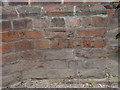
Ordnance Survey bolt on Samuel Johnson Memorial Hospital
Ordnance Survey bolt on north-east side of south entrance to Samuel Johnson Memorial Hospital. This 19th-century bench mark was established in 1851 during the First primary levelling of England & Wales, and was levelled with a height of 3311.3630 feet [94.9034 metres] above mean sea level (Liverpool datum). It was included on the Sheffield to Birmingham levelling line. The surveyor's description was "No. 216. Bolt in South side of principal entrance to Lichfield Workhouse ; 1.15 ft. above surface." (p.361)
Image: © Shantavira
Taken: 3 May 2013
0.09 miles
4

Samuel Johnson Hospital (1)
This building fronting Trent Valley Road is called the Friary Centre.
Image: © Stephen Craven
Taken: 11 Mar 2023
0.09 miles
5

Bus stop for Samuel Johnson Hospital
There are staggered bus stops both sides of Burton Road near the hospital entrance.
Image: © Stephen Craven
Taken: 11 Mar 2023
0.10 miles
6
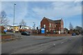
Friary Centre
Looking across Trent Valley Road towards the hospital.
Image: © DS Pugh
Taken: 11 Mar 2023
0.10 miles
7

Samuel Johnson Hospital (5)
One of the original workhouse buildings from 1840 by George Gilbert Scott and William Moffatt, this 'rear range' that originally comprised the Master's House, male and female wings, is grade II listed (list entry 1033360).
Image: © Stephen Craven
Taken: 11 Mar 2023
0.11 miles
8

Crossroads of Trent Valley Road and Wissage Road
Looking across Trent Valley Road where Wissage Road crosses. Trent Valley Road is the A5127.
Image: © DS Pugh
Taken: 11 Mar 2023
0.12 miles
9

Trent Valley Road, Lichfield
Showing the junction with Wissage Road and a chiropractic clinic on the right.
Image: © Stephen McKay
Taken: 8 Jan 2011
0.12 miles
10
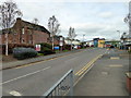
Samuel Johnson Community Hospital, Lichfield
Image: © PAUL FARMER
Taken: 23 Apr 2018
0.13 miles