
IMAGES TAKEN NEAR TO
Deans Croft, LICHFIELD, WS13 6FH
Introduction
This page details the photographs taken nearby to Deans Croft, WS13 6FH by members of the Geograph project.
The Geograph project started in 2005 with the aim of publishing, organising and preserving representative images for every square kilometre of Great Britain, Ireland and the Isle of Man.

There are currently over 7.5m images from over14,400 individuals and you can help contribute to the project by visiting https://www.geograph.org.uk
Image Map
Images are licensed for reuse under creativecommons.org/licenses/by-sa/2.0
Notes
- Clicking on the map will re-center to the selected point.
- The higher the marker number, the further away the image location is from the centre of the postcode.
Image Listing (94 Images Found)
Images are licensed for reuse under creativecommons.org/licenses/by-sa/2.0
Image
Details
Distance
1

Tesco Extra, Lichfield
Built on the site of the former cattle market, an indication of how food shopping has changed over the years.
Image: © Stephen Craven
Taken: 11 Mar 2023
0.05 miles
2
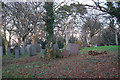
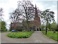
Part of the churchyard of St Michael-on-Greenhill
The churchyard is thought to be one of 5 ancient burial grounds of England, and predated a church on the site. The other four sites were at Glastonbury, Canterbury, Lindisfarne and York. It is also thought that this hill was the earliest settled part of Lichfield.
Image: © Bill Boaden
Taken: 27 Dec 2017
0.05 miles
3

The rear of ALDI in Lichfield
On St Michael's Road. See Image for the front.
Image: © Stephen Craven
Taken: 11 Mar 2023
0.07 miles
4
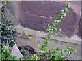
Ordnance Survey bolt on St Michael's Church
Ordnance Survey bolt on north face of St Michael's Church. This 19th-century bench mark was established in 1851 during the First primary levelling of England & Wales, and was levelled with a height of 340.9510 feet [103.9219 metres] above mean sea level (Liverpool datum). It was included as a side level on the Sheffield to Birmingham levelling line. The surveyor's description was "No. 217(a). St. Michael's Church, Lichfield. Bolt in North side of tower ; 2.47 ft. above surface." (p.361)
Image: © Shantavira
Taken: 3 May 2013
0.07 miles
5
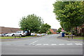
Aiden Court Road leading to Deans Croft, Lichfield
Image: © Mick Malpass
Taken: 20 Jul 2011
0.07 miles
6
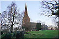
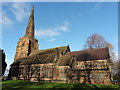
St Michael-on-Greenhill, Lichfield
An Anglican church which, as its name suggests, sits on the top of a small green hill. The building is mostly Victorian though its rots are much older.
Image: © Bill Boaden
Taken: 27 Dec 2017
0.08 miles
7
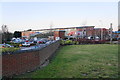
Tesco Extra, Lichfield
A large outlet a bit out of keeping with the rest of Lichfield's retail offering.
Image: © Bill Boaden
Taken: 27 Dec 2017
0.08 miles
10
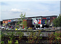
Lichfield Tesco
Looks better than Aldi's.
Image
Image: © Des Blenkinsopp
Taken: 16 Aug 2010
0.08 miles