
IMAGES TAKEN NEAR TO
Burleigh Street, WALSALL, WS1 2JU
Introduction
This page details the photographs taken nearby to Burleigh Street, WS1 2JU by members of the Geograph project.
The Geograph project started in 2005 with the aim of publishing, organising and preserving representative images for every square kilometre of Great Britain, Ireland and the Isle of Man.

There are currently over 7.5m images from over14,400 individuals and you can help contribute to the project by visiting https://www.geograph.org.uk
Image Map
Images are licensed for reuse under creativecommons.org/licenses/by-sa/2.0
Notes
- Clicking on the map will re-center to the selected point.
- The higher the marker number, the further away the image location is from the centre of the postcode.
Image Listing (40 Images Found)
Images are licensed for reuse under creativecommons.org/licenses/by-sa/2.0
Image
Details
Distance
1
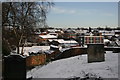
Snow over Walsall
Looking across Walsall's industrial units out to its suburbs from St Matthew's Church on a snowy day.
Image: © Derek Bennett
Taken: 14 Jan 2015
0.09 miles
2
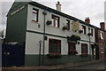
The Walsall Arms
The Walsall Arms is one of the town's old pubs.
Image: © Derek Bennett
Taken: 19 Sep 2018
0.11 miles
4
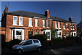
Houses on the Sutton Road
Fine old houses on the Sutton Road, Walsall.
Image: © Derek Bennett
Taken: 2 Dec 2008
0.12 miles
5
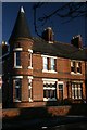
House with turret
This corner house was built with a wonderful turret.
Image: © Derek Bennett
Taken: 3 Dec 2008
0.13 miles
6
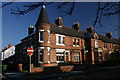
House with turret
This is a grand old property, I have always admired that turret.
Image: © Derek Bennett
Taken: 2 Dec 2008
0.13 miles
7
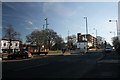
Six Ways Roundabout
Six Ways Walsall, looking towards the Sutton and Birmingham Roads from Birmingham Street.
Image: © Derek Bennett
Taken: 10 Feb 2008
0.14 miles
8
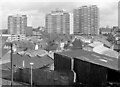
Across the rooftops, Walsall, Staffordshire
I must have been testing out my new 35-135mm zoom lens when I took this, probably from the grounds of St Matthew's Church, looking towards the tower blocks at The Chuckery. (That old Olympus OM20 SLR feels very heavy these days!) There are actually five towers. Three are clearly seen here, with another tall one poking out above the middle tower. In the centre is Tantarra Street, I think.
More on the tower blocks: http://www.watmos.org.uk/pages/a-tmo_p3.asp
The picture is from circa 1969-1972, I think, and scanned from a monochrome negative.
Image: © Roger D Kidd
Taken: 1 Jan 1972
0.15 miles
9

Boundary marker at Six Ways, Walsall.
This is in Birmingham Road, Walsall, and is quite a way from the current borough boundary. I would imagine that very few people know of its existence (or even want to know) but it is interesting particularly as it is close to the town centre and a long way from the current boundary indicating that Walsall has grown considerably in size since 1925.
Image: © Frank Smith
Taken: 4 Apr 2006
0.15 miles
