IMAGES TAKEN NEAR TO
Princes Avenue, WALSALL, WS1 2DG
Introduction
This page details the photographs taken nearby to Princes Avenue, WS1 2DG by members of the Geograph project.
The Geograph project started in 2005 with the aim of publishing, organising and preserving representative images for every square kilometre of Great Britain, Ireland and the Isle of Man.

There are currently over 7.5m images from over14,400 individuals and you can help contribute to the project by visiting https://www.geograph.org.uk
Image Map
Images are licensed for reuse under creativecommons.org/licenses/by-sa/2.0
Notes
- Clicking on the map will re-center to the selected point.
- The higher the marker number, the further away the image location is from the centre of the postcode.
Image Listing (10 Images Found)
Images are licensed for reuse under creativecommons.org/licenses/by-sa/2.0
Image
Details
Distance
1
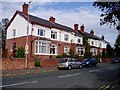
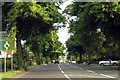
Princes Avenue, Walsall
Fairly substantial semi-detached houses, built in 1911, in the area of Walsall known as the Chuckery.
Image: © David Gruar
Taken: 23 Oct 2005
0.10 miles
3
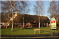
Broadway pub
This pub on the corner of the Broadway and the Crescent, Walsall, has seen a lot of changes since it was built in the sixties. A friend of mine delayed its original opening date in the mid sixties by driving around the roundabout too fast in his Mini Cooper, he hit a mound of soil at the front of the pub, flew through the air and ended up in what was the pubs outdoor. His dad was not too pleased with him at the time.
Image: © Derek Bennett
Taken: 2 Dec 2008
0.17 miles
5
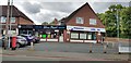
Shopping Parade at The Chuckery
The small parade on the corner of Prince's Avenue and Beacon Street contains a hairdressers, chip shop and the Broadway Cleaning Centre (a launderette).
Image: © Paul Collins
Taken: 7 Aug 2019
0.20 miles
6
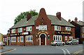
The Duke of York in The Chuckery, Walsall
Situated at the junction of Kinnerley Street and Lumley Road, this was my "local" for four years. It has not appeared in the Walsall CAMRA pub lists since the early 1990s.
Image: © Roger D Kidd
Taken: 29 Jul 2011
0.21 miles
7
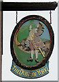
Duke of York pub sign at The Chuckery, Walsall
Image: © Roger D Kidd
Taken: 29 Jul 2011
0.21 miles
8
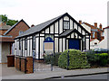
The Crescent Baptist Church in The Chuckery, Walsall
This is on the corner of The Crescent and Lumley Road.
Image: © Roger D Kidd
Taken: 29 Jul 2011
0.23 miles
9
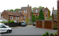
Parking area and Sutton Road housing, The Chuckery, Walsall
This is to the rear of these http://www.geograph.org.uk/photo/2732203 houses in Sutton Road (43-45). Access is from Crescent Road. The original early 20th century three storey houses have been added to with extra detached dwellings, and at least one (No 43) has been divided into three flats since at least as long ago as the 1960s. A mid 20th century small block of flats (Hale Court) is off to the right, and nine lock-up garages are off to the left.
Image: © Roger D Kidd
Taken: 29 Jul 2011
0.25 miles