
IMAGES TAKEN NEAR TO
Hawthorn Drive, CANNOCK, WS11 9UF
Introduction
This page details the photographs taken nearby to Hawthorn Drive, WS11 9UF by members of the Geograph project.
The Geograph project started in 2005 with the aim of publishing, organising and preserving representative images for every square kilometre of Great Britain, Ireland and the Isle of Man.

There are currently over 7.5m images from over14,400 individuals and you can help contribute to the project by visiting https://www.geograph.org.uk
Image Map
Images are licensed for reuse under creativecommons.org/licenses/by-sa/2.0
Notes
- Clicking on the map will re-center to the selected point.
- The higher the marker number, the further away the image location is from the centre of the postcode.
Image Listing (25 Images Found)
Images are licensed for reuse under creativecommons.org/licenses/by-sa/2.0
Image
Details
Distance
1

Hednesford Road near Brownhills West
The straight road skirts Chasewater country park between pools that speak of the area's coal mining history before reclamation. The lighting to the M6 Toll motorway may just about be seen against the distant woodland, upper left. The near side of the road is the boundary between Lichfield and Cannock Chase districts. In the foreground is the track of the Chasewater Light Railway.
Image: © Robin Stott
Taken: 8 Apr 2015
0.05 miles
2

Discarded and operational track, Chasewater light railway
The bank, left, drops steeply to flooded ground by Brownhills Road. The railway runs from Brownhills West round to Chasetown on the far side of the country park. The pylon is at SK 0286 0763.
Image: © Robin Stott
Taken: 8 Apr 2015
0.08 miles
3

Chasewater Grange under construction
Chasewater Grange is a residential development by Taylor Wimpey south of Norton Canes. The lighting columns, top centre, may be in the service area of the M6 Toll motorway. The view is from the west side of the Chasewater country park.
Image: © Robin Stott
Taken: 8 Apr 2015
0.10 miles
4

West side of Chasewater country park near Brownhills
A broad ride is bordered by low clumps of planted trees on probably made-up ground – a pleasant and characteristic scene on this western edge of Chasewater.
Image: © Robin Stott
Taken: 8 Apr 2015
0.13 miles
5
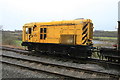
Chasewater Light Railway - diesel electric shunter
This is 08-202 one of the once ubiquitous class 08 diesel electric shunters that were to be found everywhere on the network. In typical fashion this was rumbling away with nobody obviously in attendance. I well remember that Huddersfield Station had one in a bay - it was always running but I'm not sure if I ever saw it move. By now it was raining (just like the previous Sunday).
Image: © Chris Allen
Taken: 1 Mar 2015
0.15 miles
6

Made-up ground exposed by erosion of lake shore, Chasewater near Brownhills
A number of materials are present – perhaps burnt shale, coal dust or cinders, clay, soil. A wider view of the site is Image
Image: © Robin Stott
Taken: 8 Apr 2015
0.15 miles
7

Lake shore erosion, Chasewater near Brownhills
The composite nature of the ground is apparent – (guessing) burnt shale, clay, coal dust or cinders, soil. A closer view is Image
Image: © Robin Stott
Taken: 8 Apr 2015
0.15 miles
8

Cycling in Chasewater country park near Norton Canes
This long straight track follows the edge of the Chasewater canal reservoir, beyond the bushy willows, right. The post is inscribed Beacon Way, a reference to Barr Beacon Image, a high point on the route.
Image: © Robin Stott
Taken: 8 Apr 2015
0.16 miles
9
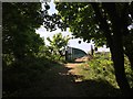
Approaching M6 Toll on foot
Footpath from Chasewater Grange housing estate up to and across M6 toll road by footbridge
Image: © Michael Westley
Taken: 9 May 2020
0.16 miles
