
IMAGES TAKEN NEAR TO
Blenheim Road, CANNOCK, WS11 9QU
Introduction
This page details the photographs taken nearby to Blenheim Road, WS11 9QU by members of the Geograph project.
The Geograph project started in 2005 with the aim of publishing, organising and preserving representative images for every square kilometre of Great Britain, Ireland and the Isle of Man.

There are currently over 7.5m images from over14,400 individuals and you can help contribute to the project by visiting https://www.geograph.org.uk
Image Map
Images are licensed for reuse under creativecommons.org/licenses/by-sa/2.0
Notes
- Clicking on the map will re-center to the selected point.
- The higher the marker number, the further away the image location is from the centre of the postcode.
Image Listing (23 Images Found)
Images are licensed for reuse under creativecommons.org/licenses/by-sa/2.0
Image
Details
Distance
1
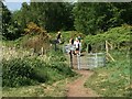
Footpath crossing Chasewater Railway
Footpath from Brownhills Road, crossing Chasewater Railway on route to Chasewater. See Image for how it looked only 5 years previously.
Image: © Michael Westley
Taken: 9 May 2020
0.12 miles
2
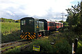
Chasewater Railway - last train of the day
On a round trip from Brownhills West Station. This was the first point where I could cross the track to get the sun on this side. The locomotive is carrying the NCB Western Area legend and is, I believe, North British 0-4-0DH No. 27876 of 1958. It is privately owned.
Image: © Chris Allen
Taken: 3 Oct 2021
0.12 miles
3
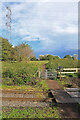
Chasewater Railway - path crossing the formation
Image: © Chris Allen
Taken: 3 Oct 2021
0.13 miles
4
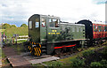
Chasewater Railway - last train of the day
On a round trip from Brownhills West Station. This was the first point where I could cross the track to get the sun on this side. The locomotive is carrying the NCB Western Area legend and is, I believe, North British 0-4-0DH No. 27876 of 1958. It is privately owned.
Image: © Chris Allen
Taken: 3 Oct 2021
0.13 miles
5
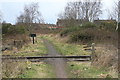
Footpath crossing railway
A path by Little Norton crosses the Chasewater Light Railway.
Image: © Chris Allen
Taken: 1 Mar 2015
0.13 miles


9

West side of Chasewater country park near Brownhills
A broad ride is bordered by low clumps of planted trees on probably made-up ground – a pleasant and characteristic scene on this western edge of Chasewater.
Image: © Robin Stott
Taken: 8 Apr 2015
0.18 miles
10
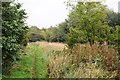
Along the former mineral railway
There are lots of colliery railways around Brownhills.
Image: © John M
Taken: 15 Oct 2013
0.19 miles