
IMAGES TAKEN NEAR TO
Gains Lane, CANNOCK, WS11 9NE
Introduction
This page details the photographs taken nearby to Gains Lane, WS11 9NE by members of the Geograph project.
The Geograph project started in 2005 with the aim of publishing, organising and preserving representative images for every square kilometre of Great Britain, Ireland and the Isle of Man.

There are currently over 7.5m images from over14,400 individuals and you can help contribute to the project by visiting https://www.geograph.org.uk
Image Map
Images are licensed for reuse under creativecommons.org/licenses/by-sa/2.0
Notes
- Clicking on the map will re-center to the selected point.
- The higher the marker number, the further away the image location is from the centre of the postcode.
Image Listing (16 Images Found)
Images are licensed for reuse under creativecommons.org/licenses/by-sa/2.0
Image
Details
Distance
1
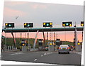
Midland Expressway Main Carriageway Toll Plaza Northbound
Image: © Paul Ashwin
Taken: 10 Jul 2005
0.09 miles
2
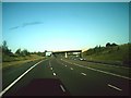
M6 toll road
The junction sign is for T7, the T at each junction I assume stands for toll. I think the emptiest motorway I have ever driven on!
Image: © andrew auger
Taken: 10 Sep 2009
0.10 miles
3
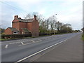
Roadside house on Watling Street
One assumes the road has always been quite noisy & busy, judging by the lack of windows & doors on the side facing the A5.
Image: © Richard Law
Taken: 14 Jan 2019
0.11 miles
4
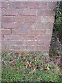
OS benchmark - 268 Watling Street
An OS cutmark low on the roadside wall of the house by the side of the A5. It was originally levelled in 1963 at 134.082m above Ordnance Datum Newlyn.
Image: © Richard Law
Taken: 14 Jan 2019
0.11 miles
6
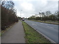
A5 Watling Street at the Washbrook Lane junction
Image: © Richard Law
Taken: 14 Jan 2019
0.16 miles

10

The Water Margin, A5
The Water Margin, Chinese Restaurant, on A5 between Cannock and Brownhills, which has been closed for several months, is built on the site of a former 16th century Inn, called the Fleur de Lys, which was destroyed by fire in the 1940's.
UPDATE
The Water Margin has also been destroyed by arson in August 2011
Image: © Mick Malpass
Taken: 15 Jun 2011
0.18 miles