
IMAGES TAKEN NEAR TO
Salop Drive, CANNOCK, WS11 8EL
Introduction
This page details the photographs taken nearby to Salop Drive, WS11 8EL by members of the Geograph project.
The Geograph project started in 2005 with the aim of publishing, organising and preserving representative images for every square kilometre of Great Britain, Ireland and the Isle of Man.

There are currently over 7.5m images from over14,400 individuals and you can help contribute to the project by visiting https://www.geograph.org.uk
Image Map
Images are licensed for reuse under creativecommons.org/licenses/by-sa/2.0
Notes
- Clicking on the map will re-center to the selected point.
- The higher the marker number, the further away the image location is from the centre of the postcode.
Image Listing (13 Images Found)
Images are licensed for reuse under creativecommons.org/licenses/by-sa/2.0
Image
Details
Distance
3
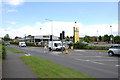
New Netto Store, Rumer Hill, Cannock
This is possibly the last Store to be built by Netto, before being bought out by Asda. The store was built on the site of the demolished Iceland & Kwik Save Stores.
Image: © Mick Malpass
Taken: 27 May 2011
0.13 miles
4
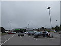
Asda on the A5190
Formerly a Lidl http://www.geograph.org.uk/photo/2431349
Image: © Basher Eyre
Taken: 16 Aug 2020
0.13 miles
6
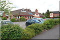
Mill Farm, Cannock
At £2.99 for breakfast and £3.69 for a carvery, you can't go wrong as it says on the sign.
Image: © Mick Malpass
Taken: 27 May 2011
0.16 miles
7
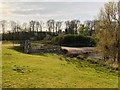
Mill Green Control Sluice
An ancient water way called The Ridings Brook flows into the Mill Green Nature Reserve in Cannock, Staffs, UK and is part dammed to create Mill Green Pool. This sluice controls the outflow from the man made pool to prevent flooding in the lower lying areas of Cannock.
Image: © BebbmeisterUK
Taken: 11 Apr 2020
0.18 miles
8
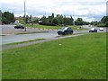
A460/A5190 Roundabout
The entrance to the Biffa Waste Disposal site, which dominates this square, can be seen at the far side of the roundabout.
Image: © Geoff Pick
Taken: 26 Jun 2007
0.19 miles
9
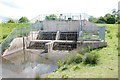
Flood Defence, Cannock.
These Flood Gates were put in to stop flooding farther down & on the A5. If there is a great deal of water coming through, the Gates can be closed & the area behind them is allowed to fill without problem.
Image: © Mick Malpass
Taken: 27 May 2011
0.20 miles
10
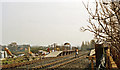
Cannock: the new station, about to be opened, 1989
View southward, towards Walsall: ex-LNW Walsall - Rugeley 'Chase' line. The station was closed when passenger services ceased from 18/1/65, but from 8/4/89 they were restored Walsall - Hednesford, then on to Rugeley Town on 2/6/97 and Rugeley Trent Valley on 25/5/98. With only a week to go, there seems to be work still to be done here. The new station was just north of the original one.
Image: © Ben Brooksbank
Taken: 31 Mar 1989
0.20 miles