
IMAGES TAKEN NEAR TO
Chaseside Drive, CANNOCK, WS11 7EY
Introduction
This page details the photographs taken nearby to Chaseside Drive, WS11 7EY by members of the Geograph project.
The Geograph project started in 2005 with the aim of publishing, organising and preserving representative images for every square kilometre of Great Britain, Ireland and the Isle of Man.

There are currently over 7.5m images from over14,400 individuals and you can help contribute to the project by visiting https://www.geograph.org.uk
Image Map
Images are licensed for reuse under creativecommons.org/licenses/by-sa/2.0
Notes
- Clicking on the map will re-center to the selected point.
- The higher the marker number, the further away the image location is from the centre of the postcode.
Image Listing (10 Images Found)
Images are licensed for reuse under creativecommons.org/licenses/by-sa/2.0
Image
Details
Distance
3
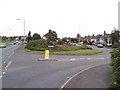
East Cannock
The junction of East Cannock Road (A460) and Lower Road.
Image: © Adrian Bailey
Taken: 2 Oct 2005
0.10 miles
5

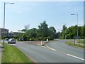
Old Direction Sign - Signpost by the A460, East Cannock Road
Lost finial - 3 arms; by the A460, in parish of Hednesford (Cannock Chase District), junction of East Cannock Road with Lower Road, in trees beyond pavement and grass verge.
To be surveyed
Milestone Society National ID: ST_SJ9911.
Image: © Milestone Society
Taken: Unknown
0.15 miles
6
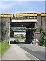
Propped bridge
The bridge has been propped for as long as I can remember. Being in the middle of the Cannock Chase coalfield it has been affected by subsidence. Mining in the local pit finished in 1982. Is it time to think about reconstruction now that a passenger service has been re-introduced between Rugeley and Cannock?
Image: © John M
Taken: 8 Jun 2008
0.16 miles
7
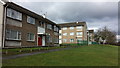
Chadsmoor, Empty houses awaiting demolition
There are a large number of houses in this area that are empty, awaiting demolition.
Image: © Mick Malpass
Taken: 25 Feb 2015
0.16 miles
8
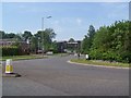
Roundabout And Railway Bridge, East Cannock Road
Image: © Geoff Pick
Taken: 10 May 2008
0.16 miles
9
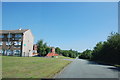
Winchester Road, Hednesford.
Looking up Winchester Road towards Hednesford, with Flats on the left and Railway line on the right behind the Trees.
Image: © Mick Malpass
Taken: 3 Jun 2011
0.19 miles
10
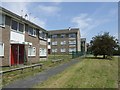
Housing in Sherwood Drive
Precast concrete system built housing on the outskirts of Cannock with regimented blocks of three storey flats.
Image: © John M
Taken: 8 Jun 2008
0.23 miles