
IMAGES TAKEN NEAR TO
Woodford End, CANNOCK, WS11 5JQ
Introduction
This page details the photographs taken nearby to Woodford End, WS11 5JQ by members of the Geograph project.
The Geograph project started in 2005 with the aim of publishing, organising and preserving representative images for every square kilometre of Great Britain, Ireland and the Isle of Man.

There are currently over 7.5m images from over14,400 individuals and you can help contribute to the project by visiting https://www.geograph.org.uk
Image Map
Images are licensed for reuse under creativecommons.org/licenses/by-sa/2.0
Notes
- Clicking on the map will re-center to the selected point.
- The higher the marker number, the further away the image location is from the centre of the postcode.
Image Listing (6 Images Found)
Images are licensed for reuse under creativecommons.org/licenses/by-sa/2.0
Image
Details
Distance
1
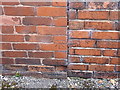
OS benchmark - Chadsmoor, 200 Huntington Terrace
An OS cutmark on the corner of 200 Huntington Terrace (the wall on the right is not part of the house, it's garden boundary). The mark was originally levelled at 171.313m above Ordnance Datum Newlyn.
Image: © Richard Law
Taken: 12 Sep 2014
0.16 miles
5
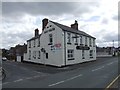
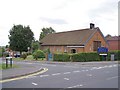
Jolly Collier PH - Chadsmoor
The former mining community is in transition with many incomers and new housing.
Image: © John M
Taken: 15 Apr 2012
0.21 miles
6
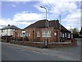
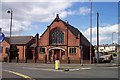
Chase Council for Voluntary Service - Arthur Road
This building was a clinic dating from before World War II. The schoolchildren were brought here to see the 'nit' nurse.
Image: © John M
Taken: 15 Apr 2012
0.23 miles