
IMAGES TAKEN NEAR TO
Watling Street, CANNOCK, WS11 1SF
Introduction
This page details the photographs taken nearby to Watling Street, WS11 1SF by members of the Geograph project.
The Geograph project started in 2005 with the aim of publishing, organising and preserving representative images for every square kilometre of Great Britain, Ireland and the Isle of Man.

There are currently over 7.5m images from over14,400 individuals and you can help contribute to the project by visiting https://www.geograph.org.uk
Image Map
Images are licensed for reuse under creativecommons.org/licenses/by-sa/2.0
Notes
- Clicking on the map will re-center to the selected point.
- The higher the marker number, the further away the image location is from the centre of the postcode.
Image Listing (31 Images Found)
Images are licensed for reuse under creativecommons.org/licenses/by-sa/2.0
Image
Details
Distance
1
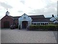
Tumbledown Farm Restaurant, Hatherton
This is a view of the restaurant from the car park.
Image: © Bill Henderson
Taken: 24 Jun 2013
0.16 miles
2
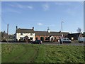
Tumble Down Farm Carvery
Barn converted to a restaurant next to the hockey and cricket club.
Image: © John M
Taken: 10 Feb 2008
0.17 miles
3
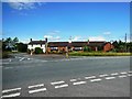
Tumbledown Farm Restaurant, Hatherton
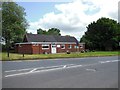
This is a view of the restaurant looking over Watling Street, the A5.
Image: © Bill Henderson
Taken: 24 Jun 2013
0.17 miles
4
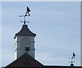
Striding Farmers
On the roof of Tumble Down Farm.
Image: © John M
Taken: 10 Feb 2008
0.17 miles
5

Hatherton Branch canal from Cat's Bridge, 1986
The long-disused canal branch heading east from Cat's Bridge, south of Four Crosses. The purpose of the notched stones is unknown but they must post-date the waterway's closure as they would surely have prevented the passage of boats. Roger Kidd has a more recent photograph from a similar location with the water extent even more restricted - https://www.geograph.org.uk/photo/790101.
The canal is gradually being reinstated - https://www.lhcrt.org.uk/index.html
Image: © Trevor Littlewood
Taken: 18 May 1986
0.17 miles
6
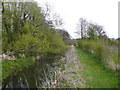
Hatherton Canal from Cats Bridge, Staffordshire
Image: © Roger D Kidd
Taken: 26 Apr 2008
0.17 miles
7
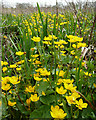
Marsh Marigolds near Saredon Brook, Staffordshire
Between the derelict Hatherton Canal and the Saredon Brook here is a potentially boggy flood plain on which these brilliant yellow flowered plants (also called Kingcups) are abundant.
Image: © Roger D Kidd
Taken: 26 Apr 2008
0.17 miles
9
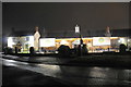
Ego Mediterranean Restaurant
A chain restaurant now occupying the site of Tumbledown Farm.
Image: © Bill Boaden
Taken: 30 Dec 2017
0.18 miles
10
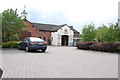
Tumble Down Farm
As the name suggests, this was a group of derelict farm buildings until a few years ago.
Image: © Mick Malpass
Taken: 10 Jun 2011
0.18 miles