
IMAGES TAKEN NEAR TO
Chaseley Croft, CANNOCK, WS11 1HU
Introduction
This page details the photographs taken nearby to Chaseley Croft, WS11 1HU by members of the Geograph project.
The Geograph project started in 2005 with the aim of publishing, organising and preserving representative images for every square kilometre of Great Britain, Ireland and the Isle of Man.

There are currently over 7.5m images from over14,400 individuals and you can help contribute to the project by visiting https://www.geograph.org.uk
Image Map
Images are licensed for reuse under creativecommons.org/licenses/by-sa/2.0
Notes
- Clicking on the map will re-center to the selected point.
- The higher the marker number, the further away the image location is from the centre of the postcode.
Image Listing (12 Images Found)
Images are licensed for reuse under creativecommons.org/licenses/by-sa/2.0
Image
Details
Distance
1
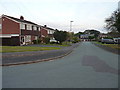
The Glade from Chaseley Avenue
Estate housing on the western side of Cannock.
Image: © Richard Law
Taken: 12 Sep 2014
0.07 miles
3
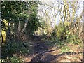
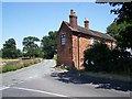
Old Penkridge Road
Now a path to and over Shoal Hill.
Image: © Richard Webb
Taken: 16 Feb 2014
0.12 miles
6
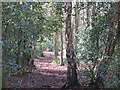
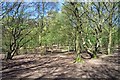
Woodland, Shoal Hill
Dense holly understorey, this bit of the wood always did give me a headache when orienteering here, very tricky.
Image: © Richard Webb
Taken: 16 Feb 2014
0.14 miles
7
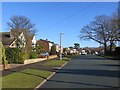
Kilmorie Road, Cannock
Very close to the woodland. A side street is named Nirvana Close.
Image: © Richard Webb
Taken: 16 Feb 2014
0.15 miles
8

Old Penkridge Road
Passing a golf course and approaching the woodland on Shoal Hill.
Image: © Richard Webb
Taken: 16 Feb 2014
0.17 miles
9

Cannock Park Golf Course
Viewed from Shoal Hill.
Image: © John M
Taken: 16 Apr 2016
0.18 miles
10
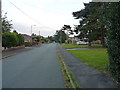
Old Penkridge Road
If the name is to be believed, once the 'main' route in or out of Cannock to the west, although it was presumably in the days of more genteel transport than the motor car. Some parts of the route survive as bridleways and lanes, such as Image and Image
Image: © Richard Law
Taken: 12 Sep 2014
0.18 miles