IMAGES TAKEN NEAR TO
Coniston Way, CANNOCK, WS11 1DT
Introduction
This page details the photographs taken nearby to Coniston Way, WS11 1DT by members of the Geograph project.
The Geograph project started in 2005 with the aim of publishing, organising and preserving representative images for every square kilometre of Great Britain, Ireland and the Isle of Man.

There are currently over 7.5m images from over14,400 individuals and you can help contribute to the project by visiting https://www.geograph.org.uk
Image Map
Images are licensed for reuse under creativecommons.org/licenses/by-sa/2.0
Notes
- Clicking on the map will re-center to the selected point.
- The higher the marker number, the further away the image location is from the centre of the postcode.
Image Listing (24 Images Found)
Images are licensed for reuse under creativecommons.org/licenses/by-sa/2.0
Image
Details
Distance
1
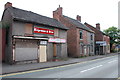
Due for Demolition, Hednesford Road, Cannock
These three buildings have been boarded up for years, but there is now talk of demolishing them, and developing the plot
Image: © Mick Malpass
Taken: 24 Aug 2011
0.09 miles
2
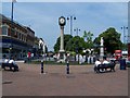
Cannock Clock Tower
In the Shopping Centre
Image: © Geoff Pick
Taken: 1 Jul 2006
0.11 miles
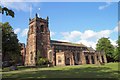
5
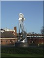
Mining sculpture
On a roundabout on the ring road this sculpture celebrates the mining carried out in the Cannock Chase Coalfield. Mining ceased at Littleton Colliery in 1993.
Image: © John M
Taken: 6 Jan 2008
0.12 miles
6
View of Cannock from top of St. Luke's Church Tower
Image: © Geoff Pick
Taken: 2 Jun 2006
0.13 miles
8
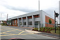
New Fire Station. Cannock
This is the new fire station on the Old Hednesford Rd, finished in 2011 it replaces the old one that was next door, which has now been demolished. Image
Image: © Mick Malpass
Taken: 5 Jun 2011
0.17 miles
9
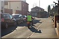
Hednesford Street
This is facing I think, South-Southwest to Mill St, and on down to the gulley linking Hednesford St and Caxton St, I believe that the gulley was part of the old original Hednesford Rd but can't prove it! There just happens to be a nice Harley in the photo as well.
Image: © Malcolm Fisher
Taken: 3 Feb 2007
0.17 miles