
IMAGES TAKEN NEAR TO
Market Place, CANNOCK, WS11 1BX
Introduction
This page details the photographs taken nearby to Market Place, WS11 1BX by members of the Geograph project.
The Geograph project started in 2005 with the aim of publishing, organising and preserving representative images for every square kilometre of Great Britain, Ireland and the Isle of Man.

There are currently over 7.5m images from over14,400 individuals and you can help contribute to the project by visiting https://www.geograph.org.uk
Image Map
Images are licensed for reuse under creativecommons.org/licenses/by-sa/2.0
Notes
- Clicking on the map will re-center to the selected point.
- The higher the marker number, the further away the image location is from the centre of the postcode.
Image Listing (53 Images Found)
Images are licensed for reuse under creativecommons.org/licenses/by-sa/2.0
Image
Details
Distance
1
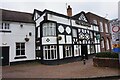
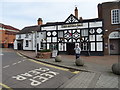
The Royal Oak public house
Market Place, Cannock.
Image: © Ian S
Taken: 18 Jan 2022
0.01 miles
3
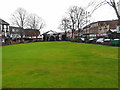
The Bowling Green
At the top of the Market Place the Bowling Green 'encompassed by brick walls' in 1753 and protected by a 1896 Deed of Trust between the Local Board (Council) and the bowlers to ensure a 'bowling green forever'.
Image: © John M
Taken: 14 Mar 2018
0.03 miles
4
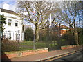
Gates, railings and gatepiers outside The Sanctuary
The rather grand street frontage of the equally impressive Image, which date from the 19th century, and which were Grade II* listed https://britishlistedbuildings.co.uk/101180287-gates-railings-and-gate-piers-of-council-house-cannock-chase#.XkOolDH7RPY & https://historicengland.org.uk/listing/the-list/list-entry/1180287 in 1973.
Image: © Richard Law
Taken: 8 Feb 2020
0.04 miles
5

Water Conduit Head and pumphouse, Cannock centre
Dating from 1736, and erected as a pumphouse for a reliable piped water supply to the town centre, which up to that time had suffered shortages, particularly in the summertime. The main cost was met by public subscriptions, and the water supply in Leacroft was donated by a Dr Birch of Leacroft Hall, which lay in the area now occupied by Image and the Orbital Shopping Centre. It supplied its water until 1942 to a series of 6 handpumps, similar to the one just on the right, and was Grade II listed https://britishlistedbuildings.co.uk/101344626-conduit-head-cannock-chase-cannock-west-ward#.XkEM0DH7RPY & https://historicengland.org.uk/listing/the-list/list-entry/1344626 in 1951.
Image: © Richard Law
Taken: 8 Feb 2020
0.04 miles
6

Conduit Building
A reliable water supply was brought into the town in 1736 with six hand pumps. The supply was abandoned in 1946.
An inscribed plaque (added in 1950) on the south-west side of the building reads: Cannock Conduit Trust founded 1736 By Public Subscription for bringing a water supply to the Township of Cannock. This building was erected in the year 1736 as the Conduit Head for the water brought by pipe from Stringer’s Meadow Rumer Hill Leacroft. The source of water being given by Dr. William Byrche of Leacroft Hall. The undertaking was endowed by the Lord of the Manor the Earl of Uxbridge, the Lord Bishop of Worcester, Sir Robert Fisher and others and later became a registered Charity and served the Township of Cannock for over 200 years.
Image: © John M
Taken: 14 Mar 2018
0.05 miles
8

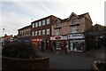
Nos 73 - 75 High Green, Cannock
A row of early 19th century houses and shops, which collectively earned a Grade II listing https://britishlistedbuildings.co.uk/101060218-71-71a-73-and-75-high-green-cannock-chase#.XkEI9zH7RPY & https://historicengland.org.uk/listing/the-list/list-entry/1060218 in 1973. They form part of a group with the adjoining no 71 which lies to the left, and Image just offshot to the right.
Image: © Richard Law
Taken: 8 Feb 2020
0.05 miles
9

77 High Green, Cannock
Formerly known as 77 and 79 High Green, but now all treated as a single address; it dates from the mid 19th century (quite possibly 1884, according to the glass above the righthand doorway) and was Grade II listed https://britishlistedbuildings.co.uk/101180307-77-high-green-cannock-chase-cannock-west-ward#.XkEKCjH7RPY & https://historicengland.org.uk/listing/the-list/list-entry/1180307 in 1973. This forms part of a group with the adjoining Image to the left.
Image: © Richard Law
Taken: 8 Feb 2020
0.05 miles
10
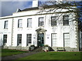
Former Council Offices
Built in the mid 18th century, and now known as The White House (very imaginatively) and formerly as The Sanctuary; a brief history is described at Image In the early 1970s, it was the offices of the local council, and at that time attracted a Grade II* listing https://britishlistedbuildings.co.uk/101060217-council-house-cannock-chase#.XkOpbTH7RPY & https://historicengland.org.uk/listing/the-list/list-entry/1060217.
Image: © Richard Law
Taken: 8 Feb 2020
0.05 miles