
IMAGES TAKEN NEAR TO
Fairmount Drive, CANNOCK, WS11 0DZ
Introduction
This page details the photographs taken nearby to Fairmount Drive, WS11 0DZ by members of the Geograph project.
The Geograph project started in 2005 with the aim of publishing, organising and preserving representative images for every square kilometre of Great Britain, Ireland and the Isle of Man.

There are currently over 7.5m images from over14,400 individuals and you can help contribute to the project by visiting https://www.geograph.org.uk
Image Map
Images are licensed for reuse under creativecommons.org/licenses/by-sa/2.0
Notes
- Clicking on the map will re-center to the selected point.
- The higher the marker number, the further away the image location is from the centre of the postcode.
Image Listing (31 Images Found)
Images are licensed for reuse under creativecommons.org/licenses/by-sa/2.0
Image
Details
Distance
1
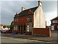
Hillbrow Villas, Mill Street
A semi-detached Edwardian property, built in 1909. One suspects there were originally more of them along here; if so, this is the only remaining example.
Image: © Richard Law
Taken: 12 Sep 2014
0.05 miles
2
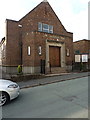
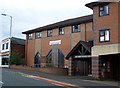
Salvation Army church on Wallhouse Street
Towards the top end of Image and just about visible in that picture, this is the church of the Salvation Army in Cannock.
Image: © Richard Law
Taken: 12 Sep 2014
0.06 miles
3
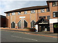
Methodist Church on Mill Street
A thoroughly modern church building, which appears to have replaced a more conventional Wesleyan chapel, although it's hard to find out how recently that happened. A popular soup kitchen operates here every weekday.
Image: © Richard Law
Taken: 12 Sep 2014
0.07 miles
4
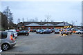
Aldi car park, Cannock
Still busy in pre-New Year trading.
Image: © Bill Boaden
Taken: 30 Dec 2017
0.07 miles
5
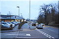
Walsall Road, Cannock
The A34 leaving Cannock town centre southwards, as winter daylight begins to fade.
Image: © Bill Boaden
Taken: 30 Dec 2017
0.08 miles
7
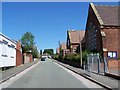
Walhouse Street
Springvale Primary School is on the right. It is due to close at the end of the Summer Term 2006.
Image: © Geoff Pick
Taken: 15 Jul 2006
0.10 miles
8
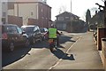
Hednesford Street
This is facing I think, South-Southwest to Mill St, and on down to the gulley linking Hednesford St and Caxton St, I believe that the gulley was part of the old original Hednesford Rd but can't prove it! There just happens to be a nice Harley in the photo as well.
Image: © Malcolm Fisher
Taken: 3 Feb 2007
0.10 miles
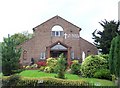
10
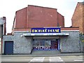
The Picture House, Cannock
About to be demolished and replaced by a new 10-screen cinema. A picture of the new complex is shown at the front.
Image: © Geoff Pick
Taken: 15 Jun 2008
0.12 miles