
IMAGES TAKEN NEAR TO
Wood Green Road, WEDNESBURY, WS10 9QU
Introduction
This page details the photographs taken nearby to Wood Green Road, WS10 9QU by members of the Geograph project.
The Geograph project started in 2005 with the aim of publishing, organising and preserving representative images for every square kilometre of Great Britain, Ireland and the Isle of Man.

There are currently over 7.5m images from over14,400 individuals and you can help contribute to the project by visiting https://www.geograph.org.uk
Image Map
Images are licensed for reuse under creativecommons.org/licenses/by-sa/2.0
Notes
- Clicking on the map will re-center to the selected point.
- The higher the marker number, the further away the image location is from the centre of the postcode.
Image Listing (29 Images Found)
Images are licensed for reuse under creativecommons.org/licenses/by-sa/2.0
Image
Details
Distance
1
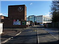
Entrance to the Wood Green Academy & school
Image: © Richard Law
Taken: 19 Feb 2012
0.03 miles
2
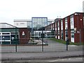
Wood Green Academy
Specialising in sport, maths and computing.
Image: © John M
Taken: 13 Apr 2013
0.06 miles
3
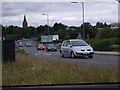
The Wood Green Road at Junction 9
On a relatively quiet day, looking towards St Paul's Church and Wednesbury with KFC hiding on the right
Image: © John Chorley
Taken: 30 Aug 2007
0.07 miles
4
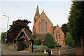
St Paul's, Wednesbury
The Parish Church of Wood Green. Church of England. The road-side surrounding wall is composed of furnace slag and the coping stones are segments of old grinding stone.
Image: © Chris Allen
Taken: 7 May 2011
0.08 miles
5
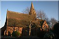
St Pauls Church
This fine looking church is situated in St Pauls Road in Wednesbury close to junction 9 on the M6.
Image: © Derek Bennett
Taken: 16 Feb 2008
0.08 miles
6
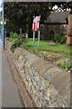
Interesting wall, Wednesbury
The roadside boundary wall of St Paul's Church. It is composed of furnace slag and the coping stones are segments of old grinding stones. There was a link between a local industrialist and the church and it is thought this explains the unusual materials in the wall. An unexpected piece of industrial archaeology that one of my friends was justifiably keen to show me.
Image: © Chris Allen
Taken: 7 May 2011
0.09 miles
7
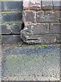
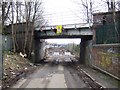
OS benchmark - Wednesbury, St Paul's Road railway bridge
Part of an OS cutmark on the bridge wall at footpath level; originally levelled at 116.748m above Ordnance Datum Newlyn.
Image: © Richard Law
Taken: 20 Apr 2015
0.10 miles
8
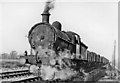
Walsall - Wednesbury freight near Bescot
View northward, towards Walsall: ex-LNW South Staffordshire line (Walsall - Dudley). After crossing over the original Grand Junction line from Birmingham to Wolverhampton via Bescot, this local freight originating from Walsall is proceeding south - just south of where the M6 now crosses the railway. The locomotive is ex-LNW No. 9171 - still unrenumbered in 1951, built as a G1 in 10/1912 and withdrawn not long after this photograph in 2/52.
Image: © Ben Brooksbank
Taken: 24 Mar 1951
0.10 miles
10
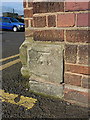
OS benchmark - Wednesbury, Wood Green High School
An OS cutmark on a cornerstone of the old school buildings; originally levelled at 118.729m above Ordnance Datum Newlyn.
Image: © Richard Law
Taken: 20 Apr 2015
0.10 miles