
IMAGES TAKEN NEAR TO
Beech Road, WEDNESBURY, WS10 9NR
Introduction
This page details the photographs taken nearby to Beech Road, WS10 9NR by members of the Geograph project.
The Geograph project started in 2005 with the aim of publishing, organising and preserving representative images for every square kilometre of Great Britain, Ireland and the Isle of Man.

There are currently over 7.5m images from over14,400 individuals and you can help contribute to the project by visiting https://www.geograph.org.uk
Image Map
Images are licensed for reuse under creativecommons.org/licenses/by-sa/2.0
Notes
- Clicking on the map will re-center to the selected point.
- The higher the marker number, the further away the image location is from the centre of the postcode.
Image Listing (12 Images Found)
Images are licensed for reuse under creativecommons.org/licenses/by-sa/2.0
Image
Details
Distance
1
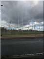
The highest rugby posts in Europe (allegedly)
Or so I was told by a chap walking his dog. Believe it if you will, but there's no doubt they're high by normal standards.
Image: © Richard Law
Taken: 19 Feb 2012
0.11 miles
3
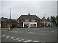
Shops on Woden Road North, Wood Green
On the corner of Simcox Road (right).
Image: © Richard Vince
Taken: 29 May 2021
0.16 miles
4
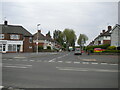
Simcox Road, Wood Green
Off Woden Road North.
Image: © Richard Vince
Taken: 29 May 2021
0.17 miles
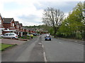
6
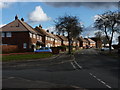
At the junction of Hawthorn Road and Ash Avenue, Kings Hill
Image: © Richard Law
Taken: 19 Feb 2012
0.21 miles
7
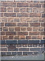
OS benchmark - Butcroft, 14 Franchise Street
An OS cutmark on the wall of no 14 Franchise Street; originally levelled at 142.698m above Ordnance Datum Newlyn.
Image: © Richard Law
Taken: 22 Jun 2016
0.21 miles
8
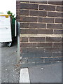
OS benchmark - Kings Hill, Black Horse public house
An OS cutmark on the front wall of Image; originally levelled at 142.915m above Ordnance Datum Newlyn.
Image: © Richard Law
Taken: 22 Jun 2016
0.22 miles
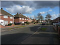
10
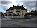
The Myvod
The public house sits at the junction of Myvod Road and Park Lane in Wood Green.
Image: © Richard Law
Taken: 19 Feb 2012
0.23 miles