
IMAGES TAKEN NEAR TO
Lime Road, WEDNESBURY, WS10 9NE
Introduction
This page details the photographs taken nearby to Lime Road, WS10 9NE by members of the Geograph project.
The Geograph project started in 2005 with the aim of publishing, organising and preserving representative images for every square kilometre of Great Britain, Ireland and the Isle of Man.

There are currently over 7.5m images from over14,400 individuals and you can help contribute to the project by visiting https://www.geograph.org.uk
Image Map
Images are licensed for reuse under creativecommons.org/licenses/by-sa/2.0
Notes
- Clicking on the map will re-center to the selected point.
- The higher the marker number, the further away the image location is from the centre of the postcode.
Image Listing (18 Images Found)
Images are licensed for reuse under creativecommons.org/licenses/by-sa/2.0
Image
Details
Distance
2
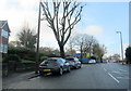
B4200 Manor House Road Wednesbury Approaching St Marys RC Primary School
Image: © Roy Hughes
Taken: 18 Dec 2017
0.08 miles
3
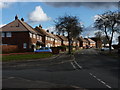
At the junction of Hawthorn Road and Ash Avenue, Kings Hill
Image: © Richard Law
Taken: 19 Feb 2012
0.13 miles
4
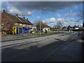
Shops on Manor House Road
A small parade of shops & a bookie, at the junction with Hawthorn Road and Hobs Road.
Image: © Richard Law
Taken: 19 Feb 2012
0.13 miles
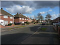
6
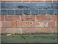
OS benchmark - Wednesbury, St Mary's Catholic Church
An OS cutmark on the north wall of the church, photographed with a bit of zoom through the fence that surrounds the church. It was last levelled by the OS in 1956 at 155.866m above Ordnance Datum Newlyn, but is shown on the 1941 map at 511.37ft above Newlyn.
Image: © Richard Law
Taken: 20 Oct 2021
0.17 miles
7
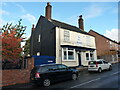
The Old Blue Ball public house
A 19th century public house, with a history of cockfighting when it was landlorded by a publican named Jonah Spittle. It attracted a Grade II listing https://britishlistedbuildings.co.uk/101077110-old-blue-ball-public-house-wednesbury-north-ward#.YXLnzhrMLIU & https://historicengland.org.uk/listing/the-list/list-entry/1077110 in 1979.
Image: © Richard Law
Taken: 20 Oct 2021
0.17 miles
8
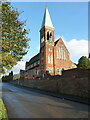
St Mary's Catholic church in Wednesbury
Built in the mid 1870s by Gilbert Blount, and Grade II listed https://britishlistedbuildings.co.uk/101077090-church-of-st-mary-wednesbury-north-ward#.YXLUVRrMLIU & https://historicengland.org.uk/listing/the-list/list-entry/1077090 in 1987.
Image: © Richard Law
Taken: 20 Oct 2021
0.18 miles
9

OS benchmark - Wednesbury, 13 Hall End
An OS cutmark on the boundary wall just around the corner from the front face of no 13 Hall End; last levelled by the OS in 1956 at 145.798m above Ordnance Datum Newlyn. It makes an appearance on the 1941 map at 478.35ft above Newlyn.
Image: © Richard Law
Taken: 20 Oct 2021
0.19 miles
10
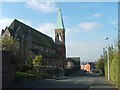
St Mary on the Hill
A Roman Catholic Church on St Mary's Road.
Image: © Gordon Griffiths
Taken: 20 Oct 2007
0.19 miles