
IMAGES TAKEN NEAR TO
Church Hill, WEDNESBURY, WS10 9DJ
Introduction
This page details the photographs taken nearby to Church Hill, WS10 9DJ by members of the Geograph project.
The Geograph project started in 2005 with the aim of publishing, organising and preserving representative images for every square kilometre of Great Britain, Ireland and the Isle of Man.

There are currently over 7.5m images from over14,400 individuals and you can help contribute to the project by visiting https://www.geograph.org.uk
Image Map
Images are licensed for reuse under creativecommons.org/licenses/by-sa/2.0
Notes
- Clicking on the map will re-center to the selected point.
- The higher the marker number, the further away the image location is from the centre of the postcode.
Image Listing (39 Images Found)
Images are licensed for reuse under creativecommons.org/licenses/by-sa/2.0
Image
Details
Distance
1
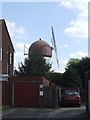
Mock windmill
A highly visible feature from a distance but well hidden away in a private garden at close range as Martin found. Image
Image: © John M
Taken: 16 Apr 2011
0.07 miles
3
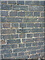
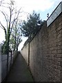
OS benchmark - Wednesbury, Church Hill (wall)
An OS cut benchmark in the churchyard wall; last levelled by the OS in 1956 at 162.193m above Ordnance Datum Newlyn. It is probably a fair bit older than that, as it appears on the 1941 map at 532.15 feet above Newlyn.
Image: © Richard Law
Taken: 20 Oct 2021
0.10 miles
5
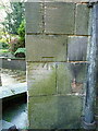
OS benchmark - Wednesbury, St Batholemew's Church
An OS cutmark on the wall of the porch at the main entrance to the church; last levelled in 1956 at 163.699m above Ordnance Datum Newlyn.
Image: © Richard Law
Taken: 20 Oct 2021
0.11 miles
6
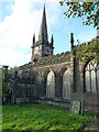
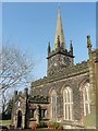
St Bartholomew's Church in Wednesbury
The church was built around 1827, but contains remnants of a much older (14th century) arch as part of the tower structure; the pulpit is early 17th century, and a table tomb in the nave is of similar date. It attracted a Grade II listing https://britishlistedbuildings.co.uk/101342678-church-of-st-bartholomew-wednesbury-north-ward#.YXLQmRrMLIU & https://historicengland.org.uk/listing/the-list/list-entry/1342678 in 1950.
Image: © Richard Law
Taken: 20 Oct 2021
0.11 miles
7
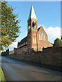
St Mary's Catholic church in Wednesbury
Built in the mid 1870s by Gilbert Blount, and Grade II listed https://britishlistedbuildings.co.uk/101077090-church-of-st-mary-wednesbury-north-ward#.YXLUVRrMLIU & https://historicengland.org.uk/listing/the-list/list-entry/1077090 in 1987.
Image: © Richard Law
Taken: 20 Oct 2021
0.12 miles
8
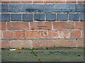
OS benchmark - Wednesbury, St Mary's Catholic Church
An OS cutmark on the north wall of the church, photographed with a bit of zoom through the fence that surrounds the church. It was last levelled by the OS in 1956 at 155.866m above Ordnance Datum Newlyn, but is shown on the 1941 map at 511.37ft above Newlyn.
Image: © Richard Law
Taken: 20 Oct 2021
0.12 miles
9
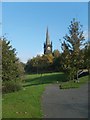
Path to Church
View to St Bartholomew's Church, Wednesbury.
Image: © Gordon Griffiths
Taken: 20 Oct 2007
0.12 miles
10
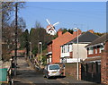
Wednesbury Windmill
There is archaeological evidence that Wednesbury did indeed once have a windmill but this isn't it. This is a folly built in a backgarden.It is difficult to get a reasonable photograph because of its location.
Image: © Martin Alford
Taken: 17 Feb 2008
0.13 miles