
IMAGES TAKEN NEAR TO
Oakeswell Street, WEDNESBURY, WS10 9AH
Introduction
This page details the photographs taken nearby to Oakeswell Street, WS10 9AH by members of the Geograph project.
The Geograph project started in 2005 with the aim of publishing, organising and preserving representative images for every square kilometre of Great Britain, Ireland and the Isle of Man.

There are currently over 7.5m images from over14,400 individuals and you can help contribute to the project by visiting https://www.geograph.org.uk
Image Map
Images are licensed for reuse under creativecommons.org/licenses/by-sa/2.0
Notes
- Clicking on the map will re-center to the selected point.
- The higher the marker number, the further away the image location is from the centre of the postcode.
Image Listing (39 Images Found)
Images are licensed for reuse under creativecommons.org/licenses/by-sa/2.0
Image
Details
Distance
2
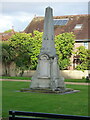
Central War Memorial, Wednesbury
Located in the Memorial Gardens, this limestone obelisk was erected in 1926 as a memorial to the fallen of WWI, and Grade II listed https://britishlistedbuildings.co.uk/101342660-central-memorial-in-memorial-gardens-wednesbury-north-ward#.YXGbSxrMLIU & https://historicengland.org.uk/listing/the-list/list-entry/1342660 in 1987.
Image: © Richard Law
Taken: 20 Oct 2021
0.10 miles
3
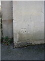
OS benchmark - Wednesbury Library
An OS cutmark low on the side wall of Image, which was levelled in 1956 at 145.475m above Ordnance Datum Newlyn.
Image: © Richard Law
Taken: 20 Oct 2021
0.10 miles
4
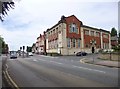
Wednesbury Library
On Walsall Street, at the corner of Hollies Drive, with a foundation stone of 1907: http://www.sandwell.gov.uk/info/200261/libraries/829/wednesbury_library
Image: © Mike Faherty
Taken: 29 Jun 2013
0.10 miles
5
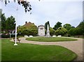
Wednesbury, war memorial
In an open space off Walsall Street. Names of the fallen are recorded on stone plaques.
Image: © Mike Faherty
Taken: 29 Jun 2013
0.11 miles
6
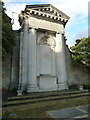
War memorial in Wednesbury
Located in the same gardens as Image, and originally erected in 1926 as a memorial to the fallen of WWI, then additional dedications were made for those lost in WWII. It too attracted a Grade II listing https://britishlistedbuildings.co.uk/101229515-memorial-attached-to-north-wall-of-memorial-gardens-wednesbury-north-ward#.YXGcgxrMLIU & https://historicengland.org.uk/listing/the-list/list-entry/1229515 in 1987.
Image: © Richard Law
Taken: 20 Oct 2021
0.11 miles
7
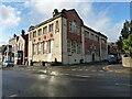
Wednesbury District Public Library
The library was built in 1907 to a design by Crouch, Butler and Savage, and attracted a Grade II listing https://britishlistedbuildings.co.uk/101077099-district-public-library-wednesbury-wednesbury-north-ward#.YXGYDhrMLIU & https://historicengland.org.uk/listing/the-list/list-entry/1077099 in 1987.
Image: © Richard Law
Taken: 20 Oct 2021
0.11 miles
8
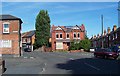
Oakeswell, Wednesbury
A nice old part of town. Sometimes spelled Oakswell.
Image: © Adrian Bailey
Taken: 21 Aug 2005
0.13 miles
9
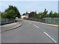
Ridding Lane crosses the railway
At the southern end of Ridding Lane, the bridge carries the road across the former South Staffs Railway line between Dudley and Walsall. The line opened in 1850, and closed to passengers in the 1960s and then to goods in 1993.
Image: © Richard Law
Taken: 26 Jul 2012
0.13 miles
10
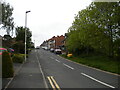
Windmill Street, Wednesbury
Off Walsall Street.
Image: © Richard Vince
Taken: 29 May 2021
0.14 miles