
IMAGES TAKEN NEAR TO
Patent Drive, WEDNESBURY, WS10 7XD
Introduction
This page details the photographs taken nearby to Patent Drive, WS10 7XD by members of the Geograph project.
The Geograph project started in 2005 with the aim of publishing, organising and preserving representative images for every square kilometre of Great Britain, Ireland and the Isle of Man.

There are currently over 7.5m images from over14,400 individuals and you can help contribute to the project by visiting https://www.geograph.org.uk
Image Map
Images are licensed for reuse under creativecommons.org/licenses/by-sa/2.0
Notes
- Clicking on the map will re-center to the selected point.
- The higher the marker number, the further away the image location is from the centre of the postcode.
Image Listing (41 Images Found)
Images are licensed for reuse under creativecommons.org/licenses/by-sa/2.0
Image
Details
Distance
1
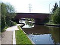
Willingworth Hall Bridge - Walsall Canal
Carries Patent Drive and gives access to a small factory estate.
Image: © Adrian Rothery
Taken: 26 Apr 2007
0.03 miles
2

Willingsworth Hall Bridge
Patent Drive crosses the Walsall Canal.
Image: © Gordon Griffiths
Taken: 13 Apr 2009
0.03 miles
3

No Bread Today
The Warburtons Vans in their depot on Easter Monday.
Image: © Gordon Griffiths
Taken: 13 Apr 2009
0.04 miles

5

Patent Drive View
The view of the Walsall Canal from Willingsworth Hall Bridge.
Image: © Gordon Griffiths
Taken: 13 Apr 2009
0.05 miles
6

Walsall Canal towards Willingworth Hall Bridge
Image: © Ian S
Taken: 16 Dec 2021
0.05 miles

8
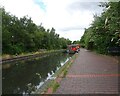
Canal Trust Workers
The Walsall Canal at Wednesbury.
Image: © Gordon Griffiths
Taken: 15 Jul 2022
0.05 miles
9
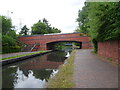
Patent Drive Bridge
The view of the Walsall Canal at Wednesbury.
Image: © Gordon Griffiths
Taken: 15 Jul 2022
0.05 miles
10

Walsall Canal at Moorcroft Junction in 1979
The main line of the Walsall Canal runs past the camera and beneath the bridge. The branch to the left is the Bradley branch which even in 1979 had been abandoned but still, in 2021 has water for a distance, and the remnants of locks. Close to the camera position, probably just behind it, there's now a road bridge not there at the time the image was made.
Image: © Trevor Littlewood
Taken: 14 Apr 1979
0.07 miles