
IMAGES TAKEN NEAR TO
Russell Street, WEDNESBURY, WS10 7AZ
Introduction
This page details the photographs taken nearby to Russell Street, WS10 7AZ by members of the Geograph project.
The Geograph project started in 2005 with the aim of publishing, organising and preserving representative images for every square kilometre of Great Britain, Ireland and the Isle of Man.

There are currently over 7.5m images from over14,400 individuals and you can help contribute to the project by visiting https://www.geograph.org.uk
Image Map
Images are licensed for reuse under creativecommons.org/licenses/by-sa/2.0
Notes
- Clicking on the map will re-center to the selected point.
- The higher the marker number, the further away the image location is from the centre of the postcode.
Image Listing (65 Images Found)
Images are licensed for reuse under creativecommons.org/licenses/by-sa/2.0
Image
Details
Distance
2
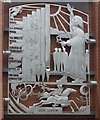
Wednesbury people and others
The others are John Wesley and the highwayman Dick Turpin who stopped in the town on his way to York.
Wednesbury is noted for the fierce riots that erupted in the town for six months in 1743 against the preachings of John Wesley.
This artwork is on the new Morrisons store.
Image: © John M
Taken: 28 Jun 2008
0.08 miles
3
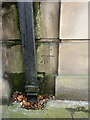
OS benchmark - Wednesbury, Town Hall
An OS cutmark beside the entrance door to Image, last levelled in 1962 at 131.497m above Ordnance Datum Newlyn. It does appear on the 1937/38 1:2500 map at a height of 431.47 ft above Liverpool datum, which rather suggests it was used in the 1st Geodetic Levelling survey, a supposition that is supported by the style of the cuts.
Image: © Richard Law
Taken: 20 Oct 2021
0.08 miles
4
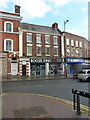
31 & 33 Market Place, Wednesbury
The 'Booze King' shop occupies a pair of late 18th century town houses which were Grade II listed https://britishlistedbuildings.co.uk/101287437-31-and-33-market-place-wednesbury-south-ward#.YXGUahrMLIU & https://historicengland.org.uk/listing/the-list/list-entry/1287437 in 1950.
Image: © Richard Law
Taken: 20 Oct 2021
0.09 miles
6

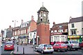
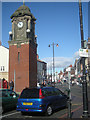
Wednesbury Clock Tower
This attractive red brick and sandstone structure was unveiled during 1911 in recognition of the coronation of George V.Wednesbury Clock Tower is grade II listed.
Image: © Stephen Rogerson
Taken: 29 Sep 2011
0.09 miles
7
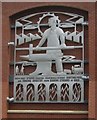
Wednesbury industry
Iron and steel working was the predominant industry throughout the 19th century and 20th centuries with the last major employer the 'Patent Shaft' closing in 1980.
This artwork is on the new Morrisons store.
Image: © John M
Taken: 28 Jun 2008
0.10 miles
8
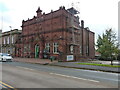
Richards Art Gallery & Museum, Wednesbury
Built in 1890 to a design by Wood and Kendrick, and now housing a collection of art and craft exhibits, along with period architecture including a fine stone staircase with cast iron balusters. It attracted a Grade II listing https://britishlistedbuildings.co.uk/101077118-richards-art-gallery-and-museum-wednesbury-south-ward#.YXGDThrMLIU & https://historicengland.org.uk/listing/the-list/list-entry/1077118 in 1987.
Image: © Richard Law
Taken: 20 Oct 2021
0.10 miles
9
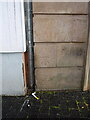
OS benchmark - Wednesbury, 30 Lower High Street
The OS cutmark lies on one of the quoin stones of the one-time bank in the market place, and was last levelled in 1956 at 139.150m above Ordnance Datum Newlyn. The building appears to be empty at present (Oct 2021)
Image: © Richard Law
Taken: 20 Oct 2021
0.10 miles
10
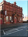
Wednesbury Museum
The Museum on the A4196 Holyhead Road.
Image: © Gordon Griffiths
Taken: 20 Oct 2007
0.10 miles