
IMAGES TAKEN NEAR TO
Friar Street, WEDNESBURY, WS10 0RE
Introduction
This page details the photographs taken nearby to Friar Street, WS10 0RE by members of the Geograph project.
The Geograph project started in 2005 with the aim of publishing, organising and preserving representative images for every square kilometre of Great Britain, Ireland and the Isle of Man.

There are currently over 7.5m images from over14,400 individuals and you can help contribute to the project by visiting https://www.geograph.org.uk
Image Map
Images are licensed for reuse under creativecommons.org/licenses/by-sa/2.0
Notes
- Clicking on the map will re-center to the selected point.
- The higher the marker number, the further away the image location is from the centre of the postcode.
Image Listing (13 Images Found)
Images are licensed for reuse under creativecommons.org/licenses/by-sa/2.0
Image
Details
Distance
1
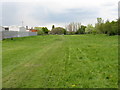
Mesty Croft - public open space beyond Oxford Street
Image: © Peter Whatley
Taken: 11 May 2010
0.06 miles
2
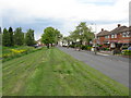
The Woods - William Green Road
To the left is a small stream, bounded by rather high levees. Presumably there is a local flooding hazard.
Image: © Peter Whatley
Taken: 11 May 2010
0.08 miles

7
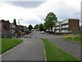
Mesty Croft - eastern end of Oxford Street
Image: © Peter Whatley
Taken: 11 May 2010
0.19 miles
8
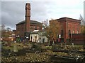
Wood Green Pumping Station
Chris Allen writes 'Now in multiple occupancy this was an early South Staffs Water Works Co. steam pumping station with beam and triple expansion engines.'
The rail line behind is not in use but is proposed to be used as part of the 5W's extension to the Midland Metro tram system (Wolverhampton, Wednesfield, Willenhall, Walsall and Wednesbury).
Image: © John M
Taken: 8 Nov 2008
0.22 miles
9
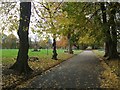
Brunswick Park, Wednesbury
The public park was laid out in the late 1880s on the site of a former pit mound, to the designs of William Barron and Son. The park is Grade 2 English Heritage listed.
Image: © John M
Taken: 8 Nov 2008
0.23 miles
10
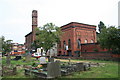
Wood Green Pumping Station
Now in multiple occupancy this was an early South Staffs Water Works Co. steam pumping station with beam and triple expansion engines.
Image: © Chris Allen
Taken: 22 Jul 2006
0.24 miles