
IMAGES TAKEN NEAR TO
Darby Road, WEDNESBURY, WS10 0PW
Introduction
This page details the photographs taken nearby to Darby Road, WS10 0PW by members of the Geograph project.
The Geograph project started in 2005 with the aim of publishing, organising and preserving representative images for every square kilometre of Great Britain, Ireland and the Isle of Man.

There are currently over 7.5m images from over14,400 individuals and you can help contribute to the project by visiting https://www.geograph.org.uk
Image Map
Images are licensed for reuse under creativecommons.org/licenses/by-sa/2.0
Notes
- Clicking on the map will re-center to the selected point.
- The higher the marker number, the further away the image location is from the centre of the postcode.
Image Listing (15 Images Found)
Images are licensed for reuse under creativecommons.org/licenses/by-sa/2.0
Image
Details
Distance
1
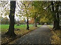
Brunswick Park, Wednesbury
The public park was laid out in the late 1880s on the site of a former pit mound, to the designs of William Barron and Son. The park is Grade 2 English Heritage listed.
Image: © John M
Taken: 8 Nov 2008
0.09 miles
2
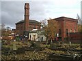
Wood Green Pumping Station
Chris Allen writes 'Now in multiple occupancy this was an early South Staffs Water Works Co. steam pumping station with beam and triple expansion engines.'
The rail line behind is not in use but is proposed to be used as part of the 5W's extension to the Midland Metro tram system (Wolverhampton, Wednesfield, Willenhall, Walsall and Wednesbury).
Image: © John M
Taken: 8 Nov 2008
0.10 miles
3
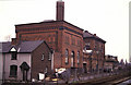
Wood Green Pumping Station
South Staffordshire Waterworks Company steam pumping station. The chimney now has cell phone excrescences and the satellite suggests the rail tracks have been replaced by trees. Triple expansion house nearest with beam engine house beyond the boiler houses. The chimney is a surprising survival.
The perspective makes it look like I'm stood in the "four foot" - I don't think I was but it was a wee while ago.
Image: © Chris Allen
Taken: 17 Apr 1988
0.11 miles
4
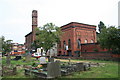
Wood Green Pumping Station
Now in multiple occupancy this was an early South Staffs Water Works Co. steam pumping station with beam and triple expansion engines.
Image: © Chris Allen
Taken: 22 Jul 2006
0.12 miles
5
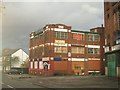
Multiple occupancy units
Next to the old South Staffs Waterworks pumping station in Wood Green.
Image: © John M
Taken: 8 Nov 2008
0.12 miles
6
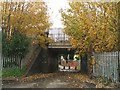
Park Hill Bridge
The rail line is no longer in use but is proposed to be used as part of the 5W's extension to the Midland Metro tram system (Wolverhampton, Wednesfield, Willenhall, Walsall and Wednesbury).
Image: © John M
Taken: 8 Nov 2008
0.15 miles
7
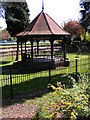
Brunswick Bandstand
The Wednesbury Park off Wood Green Road.
Image: © Gordon Griffiths
Taken: 21 Apr 2009
0.17 miles
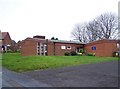
10
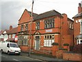
Former Parish Centre
The former 'Parish Centre' for St Paul & St Luke is for sale with planning permission for thirteen flats.
Image: © John M
Taken: 8 Nov 2008
0.19 miles