
IMAGES TAKEN NEAR TO
Mallard Place, DROITWICH, WR9 8WD
Introduction
This page details the photographs taken nearby to Mallard Place, WR9 8WD by members of the Geograph project.
The Geograph project started in 2005 with the aim of publishing, organising and preserving representative images for every square kilometre of Great Britain, Ireland and the Isle of Man.

There are currently over 7.5m images from over14,400 individuals and you can help contribute to the project by visiting https://www.geograph.org.uk
Image Map
Images are licensed for reuse under creativecommons.org/licenses/by-sa/2.0
Notes
- Clicking on the map will re-center to the selected point.
- The higher the marker number, the further away the image location is from the centre of the postcode.
Image Listing (177 Images Found)
Images are licensed for reuse under creativecommons.org/licenses/by-sa/2.0
Image
Details
Distance
1
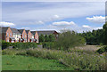
Open ground near Hill End at Droitwich, Worcestershire
The River Salwarpe is flowing from the left in the foreground between the unmowed grass and the bushes. In the distance on the right the Droitwich Junction Canal new cut goes under the road bridge carrying Impney Way, then under the M5 motorway. The housing is in Impney Green.
Image: © Roger D Kidd
Taken: 22 Aug 2010
0.05 miles
2
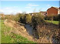
River Salwarpe
The river here is running between two modern housing estates. The restored Droitwich Junction Canal will not run along here, so this section of the river will not be canalised.
Image: © P L Chadwick
Taken: 10 Feb 2010
0.05 miles
3
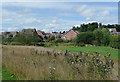
Open ground near Hill End at Droitwich, Worcestershire
This is a recently landscaped conservation area by the restored Droitwich Junction Canal, which is due to reopen for navigation later in 2011. The River Salwarpe flows by through the bushes and scrub halfway up the image.
Image: © Roger D Kidd
Taken: 22 Aug 2010
0.06 miles
4
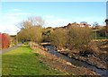
River Salwarpe
The footbridge across the river can be seen ahead, and behind the trees modern houses in Impney Way can be glimpsed. Behind them is the M5 motorway.
Image
Image: © P L Chadwick
Taken: 10 Feb 2010
0.06 miles
5
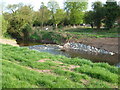
River Salwarpe - start of the canalised section
This is where the River becomes canalised with a transition section consisting of a carefully laid sloping bed of stones/boulders. The treatment of the opposite bank reflects the bed. Immediately behind the opposite bank is the terminal section of the Droitwich Junction Canal that enters the river via lock No. 7.
Image: © Chris Allen
Taken: 9 Apr 2011
0.06 miles
6
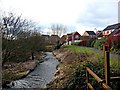
River Salwarpe
Viewed from the footbridge. This part of the river is not required for incorporation into the restored Droitwich Junction Canal, so presumably will be left much as it is now. On the right is the waterside walkway, which runs alongside for quite a distance.
Image: © P L Chadwick
Taken: 10 Feb 2010
0.06 miles
7
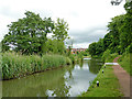
Droitwich Junction Canal in Droitwich Spa, Worcestershire
This is the reopened Droitwich Junction Canal by Lock No 7, and looking east towards Hanbury Junction.
Image: © Roger Kidd
Taken: 22 Jun 2013
0.07 miles
8
Path beginning on Swan Drive, Droitwich
This path goes through a tunnel under the railway and comes out at the bottom of Hill End Image
Image: © Jeff Gogarty
Taken: 29 Sep 2015
0.07 miles
9
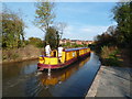
Droitwich Junction Canal - in use.
The Droitwich Canals were finally opened in July but this is the first time I've been back since about May. This is the first boat I've seen transiting the Droitwich Junction Canal and it has just left lock No. 7 and is heading towards the Birmingham and Worcester Canal. The gratings in the foreground cover the entrance to the bywash that carries water betweemn the two canals past the canalised River Salwarpe.
Image: © Chris Allen
Taken: 1 Oct 2011
0.07 miles
10
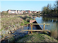
Droitwich Junction Canal - overflow
This is where the water from the Body Brook flows back into the River Salwarpe.
Image: © Chris Allen
Taken: 2 Mar 2013
0.07 miles