IMAGES TAKEN NEAR TO
Sandles Close, DROITWICH, WR9 8RB
Introduction
This page details the photographs taken nearby to Sandles Close, WR9 8RB by members of the Geograph project.
The Geograph project started in 2005 with the aim of publishing, organising and preserving representative images for every square kilometre of Great Britain, Ireland and the Isle of Man.

There are currently over 7.5m images from over14,400 individuals and you can help contribute to the project by visiting https://www.geograph.org.uk
Image Map
Images are licensed for reuse under creativecommons.org/licenses/by-sa/2.0
Notes
- Clicking on the map will re-center to the selected point.
- The higher the marker number, the further away the image location is from the centre of the postcode.
Image Listing (20 Images Found)
Images are licensed for reuse under creativecommons.org/licenses/by-sa/2.0
Image
Details
Distance
1
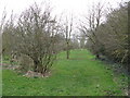
Footpath Through The Trees
Opposite the entry to Oakley Farm.
Image: © Peter Whatley
Taken: 23 Mar 2010
0.08 miles
3
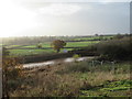
New pond next to Yew Tree Hill development, Droitwich
Image: © Jeff Gogarty
Taken: 26 Nov 2019
0.12 miles
4
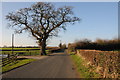
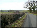
Oak tree on Pulley Lane
Oak tree on Pulley Lane at the entrance to a farm.
Image: © Philip Halling
Taken: 15 Jan 2012
0.13 miles
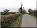
5
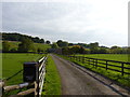
Lane to Oakley Farm, Pulley Lane, Droitwich
Image: © Jeff Gogarty
Taken: 11 Oct 2015
0.16 miles
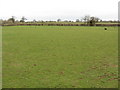
7
Pulley Lane
Pulley Lane lies just beyond the urban fringe of Droitwich.
Image: © Philip Halling
Taken: 15 Jan 2012
0.17 miles
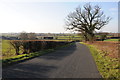
8
Pulley Lane approaching Oakley Farm, Droitwich
Image: © Roy Hughes
Taken: 12 Dec 2021
0.18 miles
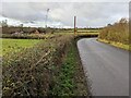
9
Pulley Lane
Looking west in the direction of Droitwich.
The farm on the left is Oakley.
Image: © Jonathan Billinger
Taken: 16 Feb 2009
0.20 miles
10
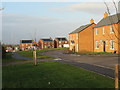
Goldcrest Way and unlabelled road, Yew Tree Hill development
Image: © Jeff Gogarty
Taken: 26 Nov 2019
0.21 miles