1
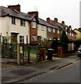
Row of three houses, Manning Road, Droitwich
Viewed from the corner of Burrish Street.
Image: © Jaggery
Taken: 16 Nov 2016
0.01 miles
2
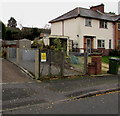
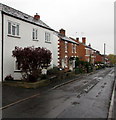
Manning Road houses, Droitwich
On the south side of the road, near the Burrish Street junction.
Image: © Jaggery
Taken: 16 Nov 2016
0.01 miles
3
Manning Road electricity substation, Droitwich
The Western Power Distribution electricity substation is inside a locked compound
on the south side of Manning Road. Its identifier is MANNING ROAD 33397 (77/5837).
Image: © Jaggery
Taken: 16 Nov 2016
0.02 miles
4
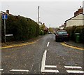
Southern end of Burrish Street, Droitwich
Viewed across Manning Road. The sign on the left shows that Burrish Street is not a through route for motor vehicles.
Image: © Jaggery
Taken: 16 Nov 2016
0.02 miles
5
Junction at the southern end of Miller Street, Droitwich
Viewed from Miller Street. Spa Road is on the left, Manning Road out of shot on the right.
Image: © Jaggery
Taken: 16 Nov 2016
0.04 miles
6
South along Burrish Street, Droitwich
Towards Manning Road from near these http://www.geograph.org.uk/photo/5202076 posts.
Image: © Jaggery
Taken: 16 Nov 2016
0.05 miles
7
Spa Road, Droitwich
The junction of Blackfriars Avenue and Spa Road, leading to Manning Road.
Image: © Mary and Angus Hogg
Taken: 6 Dec 2012
0.06 miles
8
Spa Dental Surgery, Blackfriars Avenue
Junction of Fabricious Avenue, Blackfriars Avenue and Spa Road, Droitwich Spa, Worcestershire
Image: © Jeff Gogarty
Taken: 3 May 2015
0.06 miles
9
West side of Burrish Street, Droitwich
Burrish Street extends from Manning Road (behind the camera) to Ombersley Street West.
Image: © Jaggery
Taken: 16 Nov 2016
0.07 miles
10
Sunset in Droitwich Spa
From Wedgberrow Close.
Image: © Jeff Gogarty
Taken: 12 Apr 2022
0.07 miles


