
IMAGES TAKEN NEAR TO
St. Andrews Road, DROITWICH, WR9 8DJ
Introduction
This page details the photographs taken nearby to St. Andrews Road, WR9 8DJ by members of the Geograph project.
The Geograph project started in 2005 with the aim of publishing, organising and preserving representative images for every square kilometre of Great Britain, Ireland and the Isle of Man.

There are currently over 7.5m images from over14,400 individuals and you can help contribute to the project by visiting https://www.geograph.org.uk
Image Map
Images are licensed for reuse under creativecommons.org/licenses/by-sa/2.0
Notes
- Clicking on the map will re-center to the selected point.
- The higher the marker number, the further away the image location is from the centre of the postcode.
Image Listing (487 Images Found)
Images are licensed for reuse under creativecommons.org/licenses/by-sa/2.0
Image
Details
Distance

2

BMI, The Droitwich Spa Hospital (and Brine Baths)
The hospital is a private hospital.The Brine Baths are now closed and don't look likely to re-open. Brine baths are what put the Spa in the town's name. The one way street is St Andrew's Road.
Image: © Jeff Gogarty
Taken: 2 Dec 2015
0.03 miles
3

St Richard's House
St Richard's House contains Droitwich's Heritage Centre, Tourist Information, and the Salt Museum. The building stands on the site of the former Brine Baths built by the 'Salt King' John Corbett Image
Image: © Philip Halling
Taken: 14 Dec 2020
0.04 miles
4

Blue plaque on St Richard's House
Image: © Philip Halling
Taken: 14 Dec 2020
0.04 miles
5

St Richard's House, Victoria Square, Droitwich
The building on the left is St Richards House. The part nearest is the Museuam and behind the porch is the Tourist Information Centre. The building also contains the council chambers and the registry office.
The building ahead is the library.
Image: © Jeff Gogarty
Taken: 2 Dec 2015
0.04 miles
6
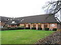
Droitwich Spa - Brine bath
This was part of the BMI private hospital. It has since closed due to corrosion and electrical safety issues. It is now just part of the hospital and no longer a brine bath.
Image: © Chris Allen
Taken: 9 Dec 2007
0.04 miles
7

Droitwich Heritage & Information Centre, Droitwich Spa
Located in St Richards House, 22 Victoria Square.
Image: © Jaggery
Taken: 16 Nov 2016
0.05 miles
8

The Worcestershire apartment complex, Droitwich Spa
On the site of the Worcestershire Hotel and Brine Baths. The site was redeveloped after the listed hotel was allowed to decay beyond repair.
http://www.francisfrith.com/uk/droitwich-spa/droitwich-worcestershire-hotel-1904_51942
At the junction of Worcester Road and St Andrews Road
Image: © Jeff Gogarty
Taken: 3 May 2015
0.05 miles
9

St Andrew's Road, Droitwich Spa
On the right is the start of Worcestershire apartment complex which extends to the Worcester Road Image On the left is part of the closed Raven Hotel.
Image: © Jeff Gogarty
Taken: 2 Dec 2015
0.05 miles
10
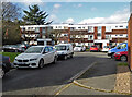
Cobham Court, Droitwich
Blocks of flats off Corbett Avenue, Droitwich. I lived in the bottom left one with my sister from 1977 to 1987.
Image: © Chris Allen
Taken: 16 Feb 2019
0.05 miles