
IMAGES TAKEN NEAR TO
Hanbury, DROITWICH, WR9 7DZ
Introduction
This page details the photographs taken nearby to WR9 7DZ by members of the Geograph project.
The Geograph project started in 2005 with the aim of publishing, organising and preserving representative images for every square kilometre of Great Britain, Ireland and the Isle of Man.

There are currently over 7.5m images from over14,400 individuals and you can help contribute to the project by visiting https://www.geograph.org.uk
Image Map
Images are licensed for reuse under creativecommons.org/licenses/by-sa/2.0
Notes
- Clicking on the map will re-center to the selected point.
- The higher the marker number, the further away the image location is from the centre of the postcode.
Image Listing (19 Images Found)
Images are licensed for reuse under creativecommons.org/licenses/by-sa/2.0
Image
Details
Distance

2

View towards the Malverns
Believe the buildings must be Mere Green
Taken from local high point off Loggerhead Lane, Hanbury (286 ft/ 87.17 metres)
Image: © Jeff Gogarty
Taken: 7 Jun 2015
0.02 miles
3
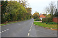
The Saltway looking west
The old Roman road ("Saltway") B4090 looking west (towards Droitwich) from by the entrance to the Mere Green Business Village.
Image: © Mike Dodman
Taken: 28 Oct 2016
0.04 miles
4

Entrance to Mere Green Business Village
A small business park just east of Droitwich.
Image: © Richard Law
Taken: 14 Dec 2010
0.06 miles
5

Footpath & stile in fields north of Mere Green
The grass field on this side of the bridge is a trick - on the far side of the stile and bridge awaited a recently harrowed field, with a large amount of the world's stickiest mud (OK, Worcestershire's stickiest mud, anyway.)
Image: © Richard Law
Taken: 14 Dec 2010
0.09 miles
6

Salt Way and Roman Road
Salt Way and Roman Road, now the B4090 at Mere Green.
Image: © Philip Halling
Taken: 20 Feb 2015
0.11 miles
7

The salt way east of Droitwich
A busy route right up to the present day
Image: © Andrew Darge
Taken: 20 Jun 2006
0.15 miles
8

Arable field at Mere Green
Large arable field at Mere Green, the Malvern Hills are on the horizon.
Image: © Philip Halling
Taken: 20 Feb 2015
0.17 miles
9

Mere Green farmhouse
A substantial farm and buildings on the B4090 Salt Way road.
Image: © Richard Law
Taken: 14 Dec 2010
0.17 miles
10
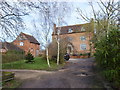
Mere Green Farmhouse, Salt Way, Hanbury
Image: © Jeff Gogarty
Taken: 4 Mar 2019
0.18 miles