
IMAGES TAKEN NEAR TO
Rushock, DROITWICH, WR9 0NR
Introduction
This page details the photographs taken nearby to WR9 0NR by members of the Geograph project.
The Geograph project started in 2005 with the aim of publishing, organising and preserving representative images for every square kilometre of Great Britain, Ireland and the Isle of Man.

There are currently over 7.5m images from over14,400 individuals and you can help contribute to the project by visiting https://www.geograph.org.uk
Image Map
Images are licensed for reuse under creativecommons.org/licenses/by-sa/2.0
Notes
- Clicking on the map will re-center to the selected point.
- The higher the marker number, the further away the image location is from the centre of the postcode.
Image Listing (5 Images Found)
Images are licensed for reuse under creativecommons.org/licenses/by-sa/2.0
Image
Details
Distance
1

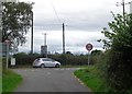
Entrance to Rushock Trading Estate
Same place a few years later. See Image
Image: © Mike Dodman
Taken: 12 Jul 2012
0.05 miles

4
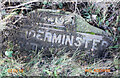
Old Milestone, on the A442, Callimore Farm
Located on the East side of road, Lying flat on verge. Metal plate attached to concrete post, Bradley post design, erected by the County Council, 20th century.
Inscription reads: B4192 / 5 KIDDERMINSTER / DROITWICH 5 // C. C. W.
Milestone Society National ID: WO_KDDW05
Image: © Lawrence Lee
Taken: 7 Mar 2015
0.22 miles
5
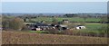
Callimore Farm, Rushock, Worcestershire
Several businesses operate out of Callimore Farm under the umbrella name of Cedarstone Limited.
Image: © Jeff Gogarty
Taken: 26 Dec 2017
0.23 miles