IMAGES TAKEN NEAR TO
Colley Pits Lane, WR9 0FP
Introduction
This page details the photographs taken nearby to Colley Pits Lane, WR9 0FP by members of the Geograph project.
The Geograph project started in 2005 with the aim of publishing, organising and preserving representative images for every square kilometre of Great Britain, Ireland and the Isle of Man.

There are currently over 7.5m images from over14,400 individuals and you can help contribute to the project by visiting https://www.geograph.org.uk
Image Map
Images are licensed for reuse under creativecommons.org/licenses/by-sa/2.0
Notes
- Clicking on the map will re-center to the selected point.
- The higher the marker number, the further away the image location is from the centre of the postcode.
Image Listing (8 Images Found)
Images are licensed for reuse under creativecommons.org/licenses/by-sa/2.0
Image
Details
Distance
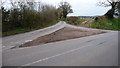
2

Almost to the top
Colley Pits Lane joins Crutch Lane on the Right at the top of hill near Cooksey Corner.
Image: © Jeff Gogarty
Taken: 28 May 2018
0.14 miles


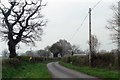
5

Entrance to Cooksey Lodge Farm, Berry Lane, Elmbridge
Image: © Jeff Gogarty
Taken: 20 May 2016
0.16 miles

8

Farm machinery on Cooksey Lodge Farm, Upton Warren
Image: © Philip Halling
Taken: 11 Mar 2006
0.24 miles