IMAGES TAKEN NEAR TO
Wadborough, WORCESTER, WR8 9HJ
Introduction
This page details the photographs taken nearby to WR8 9HJ by members of the Geograph project.
The Geograph project started in 2005 with the aim of publishing, organising and preserving representative images for every square kilometre of Great Britain, Ireland and the Isle of Man.

There are currently over 7.5m images from over14,400 individuals and you can help contribute to the project by visiting https://www.geograph.org.uk
Image Map
Images are licensed for reuse under creativecommons.org/licenses/by-sa/2.0
Notes
- Clicking on the map will re-center to the selected point.
- The higher the marker number, the further away the image location is from the centre of the postcode.
Image Listing (13 Images Found)
Images are licensed for reuse under creativecommons.org/licenses/by-sa/2.0
Image
Details
Distance
1
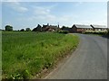
Wadborough Hall Farm
Since this farm was first photographed for this website in 2005 some of the farm buildings have been converted into residential accommodation.
Image: © Philip Halling
Taken: 2 Jun 2016
0.01 miles
3
Wadborough Barn Conversions
Not a lot happening in the depressed 2008 housing market.
Image: © Peter Whatley
Taken: 15 Oct 2008
0.02 miles
4
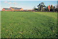
Wadborough Hall Farm across the fields
Image: © Jeff Gogarty
Taken: 12 Jan 2019
0.02 miles
5
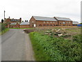
Wadborough Hall Farm
View north-east to the farmhouse on the right and a cluster of barns (some converted) on the left.
Image: © Trevor Rickard
Taken: 13 Nov 2010
0.03 miles
6
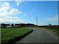
Grazing land near Wadborough
Looking south-east from near Wadborough Hall Farm towards Bredon Hill in the distance. To the left of the power lines is Deerfold Wood.
Image: © Trevor Rickard
Taken: 13 Nov 2010
0.12 miles
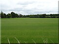
8
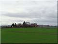
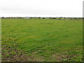
Field to the south-east of Wadborough Hill Farm
Wadborough Hill Farm which is situated in the next grid square can be seen to the right of centre.
Image: © Philip Halling
Taken: 18 Feb 2007
0.16 miles
10
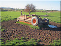
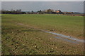
Roller at Wadborough Hall Farm
View north-west with the Malvern Hills in the distance on the left. Judging from the wear and tear on the ground, this implement has been parked here for some time and will be used as a cattle rubbing post. The roller has a clever design - pulled from the right when in use; pulled from the far end with the two wheels lowered by hydraulics when being moved to another field or being towed on the road.
Image: © Trevor Rickard
Taken: 13 Nov 2010
0.21 miles