
IMAGES TAKEN NEAR TO
Brotheridge Green, WORCESTER, WR8 0BB
Introduction
This page details the photographs taken nearby to Brotheridge Green, WR8 0BB by members of the Geograph project.
The Geograph project started in 2005 with the aim of publishing, organising and preserving representative images for every square kilometre of Great Britain, Ireland and the Isle of Man.

There are currently over 7.5m images from over14,400 individuals and you can help contribute to the project by visiting https://www.geograph.org.uk
Image Map
Images are licensed for reuse under creativecommons.org/licenses/by-sa/2.0
Notes
- Clicking on the map will re-center to the selected point.
- The higher the marker number, the further away the image location is from the centre of the postcode.
Image Listing (36 Images Found)
Images are licensed for reuse under creativecommons.org/licenses/by-sa/2.0
Image
Details
Distance
1
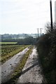
The Track from Tuck Mill
Heading down from the electricity sub-station towards the lane running from Brotheridge Green to Hanley Castle.
Image: © Bob Embleton
Taken: 10 Feb 2008
0.05 miles
2
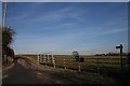
The Track to Tuck Mill
From the Brotheridge to Hanley Castle road.
Image: © Bob Embleton
Taken: 10 Feb 2008
0.05 miles
3
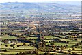
Route of the old railway line to Upton
Taken from the "saddle" between the two peaks of Pinnacle Hill on the Malverns.
The avenue of trees running straight away from the camera border the old railway.
The spires of both the old and the victorian replacement churches of Upton can be seen in the middle distance.
Bredon Hill on the far side of the Severn Plain provides the backdrop with the Cotswold escarpment beyond.
Image: © Bob Embleton
Taken: 10 Nov 2013
0.06 miles
4
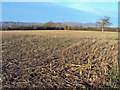
Sweetcorn stubble at Brotheridge Green
Looking north-west across a recently harvested maize crop. The Malvern Hills in the distance.
Image: © Trevor Rickard
Taken: 4 Dec 2009
0.08 miles
5

Old Railway Crossing
An old unmanned farm track crossing of the Malvern to Upton Railway line with a gate that has seen better days.
Image: © Bob Embleton
Taken: 10 Feb 2008
0.11 miles
6
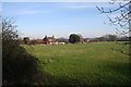
Woodlands
On the road from Brotheridge Green. Taken from the old crossing over the dismantled Malvern to Upton railway.
Image: © Bob Embleton
Taken: 10 Feb 2008
0.12 miles
7
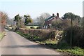
The Road to the Castle at Hanley
A once very important routeway through Malvern Chase: now a very quiet country lane. Woodlands is on the right with a splendid display of mistletoe.
Image: © Bob Embleton
Taken: 10 Feb 2008
0.12 miles
8
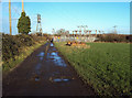
Electricity sub-station at Brotheridge Green
Looking north along the track to Gilbert's End. Farm roller parked on the right. The high voltage line on the left heads for Ledbury via an underground section across the Malvern Hills - see Image
Image: © Trevor Rickard
Taken: 4 Dec 2009
0.13 miles
9
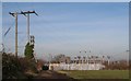
Brotheridge Green Electricity Sub-Station
Along the lane to the Tuck Mill
Image: © Bob Embleton
Taken: 10 Feb 2008
0.13 miles
10
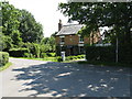
Gilver's Lane - centre of the hamlet
The junction forming the core of the hamlet is faced by this rather attractive B&B establishment.
Image: © Peter Whatley
Taken: 8 Jun 2008
0.14 miles