IMAGES TAKEN NEAR TO
Haylers End, WORCESTER, WR8 0AL
Introduction
This page details the photographs taken nearby to Haylers End, WR8 0AL by members of the Geograph project.
The Geograph project started in 2005 with the aim of publishing, organising and preserving representative images for every square kilometre of Great Britain, Ireland and the Isle of Man.

There are currently over 7.5m images from over14,400 individuals and you can help contribute to the project by visiting https://www.geograph.org.uk
Image Map (Loading...)


Getting Data...Please wait
Leaflet Map data © OpenStreetMap
Images are licensed for reuse under creativecommons.org/licenses/by-sa/2.0
Notes
- Clicking on the map will re-center to the selected point.
- The higher the marker number, the further away the image location is from the centre of the postcode.
Image Listing (32 Images Found)
Images are licensed for reuse under creativecommons.org/licenses/by-sa/2.0
Image
Details
Distance
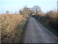
1
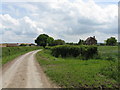
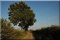
Lane to Broadacres Farm
The southerly of the two lanes leading off Tickeridge Farm Lane.
Image: © Peter Whatley
Taken: 6 Jun 2008
0.02 miles
2
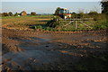
Muddy gateway, near Tickeridge Farm
This muddy gateway is off a no through road to the east of Tickeridge Farm, the house in the background in unnamed on the OS map.
Image: © Philip Halling
Taken: 12 Oct 2008
0.05 miles
3
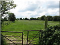
Farmland at Broadacres Farm
Farmland at Broadacres Farm near Hanley Swan.
Image: © Philip Halling
Taken: 19 Sep 2020
0.05 miles
5
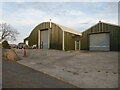
Sheds and an old car near Hanley Swan
Most probably associated with farming/agriculture.
Image: © Chris Allen
Taken: 14 Aug 2022
0.10 miles
6
No through road near Hanley Swan
This is a no through road to the east of Tickeridge Farm, it provides access to farmland.
Image: © Philip Halling
Taken: 12 Oct 2008
0.10 miles
7
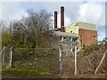
Disused Hayler's End Incinerator
In the ten years since I last photographed this disused incinerator the building has deteriorated and site become overgrown Image
Image: © Philip Halling
Taken: 12 Nov 2017
0.11 miles
8
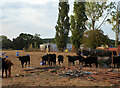
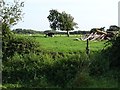
Young cattle near Hanley Swan
Seen from Hangman's Lane near the Hayler's End clinical waste incinerator.
Image: © Chris Allen
Taken: 14 Aug 2022
0.11 miles
9
Lane to Broadacres Farm
Eastwards view with the footpath finger post just ahead.
Image: © Trevor Rickard
Taken: 19 Dec 2007
0.12 miles
10
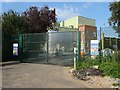
Malvern Clinical Waste Incineration Facility
This incinerator was closed and became redundant in 1995 Image, it has recently been redeveloped by Cobalt Energy Image
Image: © Philip Halling
Taken: 19 Sep 2020
0.12 miles