IMAGES TAKEN NEAR TO
Pershore Road, WORCESTER, WR7 4RL
Introduction
This page details the photographs taken nearby to Pershore Road, WR7 4RL by members of the Geograph project.
The Geograph project started in 2005 with the aim of publishing, organising and preserving representative images for every square kilometre of Great Britain, Ireland and the Isle of Man.

There are currently over 7.5m images from over14,400 individuals and you can help contribute to the project by visiting https://www.geograph.org.uk
Image Map
Images are licensed for reuse under creativecommons.org/licenses/by-sa/2.0
Notes
- Clicking on the map will re-center to the selected point.
- The higher the marker number, the further away the image location is from the centre of the postcode.
Image Listing (10 Images Found)
Images are licensed for reuse under creativecommons.org/licenses/by-sa/2.0
Image
Details
Distance
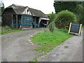
1
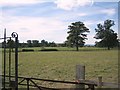
Caldewell Farm, Pershore Road, Stoulton
The coach house has been converted into separate property and possibly other parts of the property which included a Tythe Barn, Smithy, Granary and Dairy as well as the main house.
Image: © Jeff Gogarty
Taken: 12 Jan 2019
0.01 miles

3
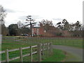
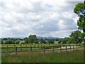
Caldewell
Caldewell House and parkland from the Pershore - Worcester road, looking south-west towards the Malverns.
Image: © Dave Bushell
Taken: 7 Sep 2005
0.15 miles
4
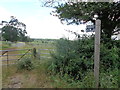
Chose your mode of transport
Foot, horse or cycling are all allowed on this bridleway to Great Blaythorn Wood.
Image: © Jeff Gogarty
Taken: 24 Jun 2017
0.18 miles
5
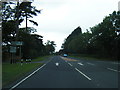
Road to Caldewell from the B4084
With the Malvern Hills in the distance.
Image: © Jeff Gogarty
Taken: 24 Jun 2017
0.19 miles

7
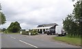
Farm Shop south-east of Stoulton, on B4084
Image: © David Smith
Taken: 16 Jun 2018
0.23 miles
8
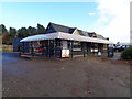
The Farm Shop, on B4084 at Windmill Hill
Image: © Jeff Gogarty
Taken: 19 Nov 2016
0.23 miles
9
Snodsbury Farms, Windmill Hill
Farm shop beside the B4084 at Windmill Hill
Image: © Philip Halling
Taken: 10 Aug 2008
0.24 miles