IMAGES TAKEN NEAR TO
Priory Farm Lane, WORCESTER, WR7 4HU
Introduction
This page details the photographs taken nearby to Priory Farm Lane, WR7 4HU by members of the Geograph project.
The Geograph project started in 2005 with the aim of publishing, organising and preserving representative images for every square kilometre of Great Britain, Ireland and the Isle of Man.

There are currently over 7.5m images from over14,400 individuals and you can help contribute to the project by visiting https://www.geograph.org.uk
Image Map
Images are licensed for reuse under creativecommons.org/licenses/by-sa/2.0
Notes
- Clicking on the map will re-center to the selected point.
- The higher the marker number, the further away the image location is from the centre of the postcode.
Image Listing (60 Images Found)
Images are licensed for reuse under creativecommons.org/licenses/by-sa/2.0
Image
Details
Distance
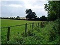
1
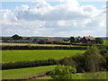
Perry Fields Farm, Inkberrow from the church
Image: © Jeff Gogarty
Taken: 9 Oct 2016
0.01 miles
6
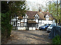
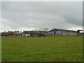
Rock Cottages, Inkberrow
Grade II Listed. Late 17th century with 20th century alterations. Timber framed on a stone plinth and with a tiled roof. Contiguous to the left with Rock End Cottage.
Image: © Chris Allen
Taken: 16 Apr 2022
0.12 miles
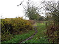
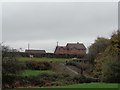
9
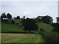
Footpath leading to Garrets Hill
The hill is known locally as Garrets hill.
Image: © Claire Seyler
Taken: 11 Sep 2007
0.14 miles
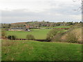
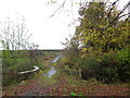
10
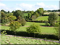
Valley below St Peter's Church, Inkberrow
Image: © Jeff Gogarty
Taken: 9 Oct 2016
0.15 miles