IMAGES TAKEN NEAR TO
Crowle, WORCESTER, WR7 4AZ
Introduction
This page details the photographs taken nearby to WR7 4AZ by members of the Geograph project.
The Geograph project started in 2005 with the aim of publishing, organising and preserving representative images for every square kilometre of Great Britain, Ireland and the Isle of Man.

There are currently over 7.5m images from over14,400 individuals and you can help contribute to the project by visiting https://www.geograph.org.uk
Image Map
Images are licensed for reuse under creativecommons.org/licenses/by-sa/2.0
Notes
- Clicking on the map will re-center to the selected point.
- The higher the marker number, the further away the image location is from the centre of the postcode.
Image Listing (4 Images Found)
Images are licensed for reuse under creativecommons.org/licenses/by-sa/2.0
Image
Details
Distance
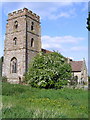
1
Church Road Near Crowle With Public Bridleway Sign
Image: © Roy Hughes
Taken: 9 Feb 2018
0.07 miles
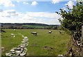
2
Field view
The view towards Crowle from the footpath near Broughton Hackett.
Image: © Gordon Griffiths
Taken: 2 Sep 2011
0.15 miles