
IMAGES TAKEN NEAR TO
Froxmere Road, WORCESTER, WR7 4AL
Introduction
This page details the photographs taken nearby to Froxmere Road, WR7 4AL by members of the Geograph project.
The Geograph project started in 2005 with the aim of publishing, organising and preserving representative images for every square kilometre of Great Britain, Ireland and the Isle of Man.

There are currently over 7.5m images from over14,400 individuals and you can help contribute to the project by visiting https://www.geograph.org.uk
Image Map
Images are licensed for reuse under creativecommons.org/licenses/by-sa/2.0
Notes
- Clicking on the map will re-center to the selected point.
- The higher the marker number, the further away the image location is from the centre of the postcode.
Image Listing (20 Images Found)
Images are licensed for reuse under creativecommons.org/licenses/by-sa/2.0
Image
Details
Distance
1
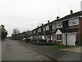
Crowle - Froxmere Road Housing
Away from the old heart of the village is an extensive modern estate.
Image: © Peter Whatley
Taken: 23 Mar 2010
0.03 miles
2
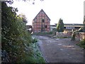
Barn, Rectory Farm, Crowle
Viewed from the east. Timber framed with brick infill.
Image: © Bob Embleton
Taken: 18 Nov 2005
0.12 miles
3
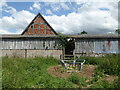
Barn about 50 yards south-west of Rectory Farmhouse, Crowle
Barn c1600 and extended mid-17th century. Timber framed with brick infill on a masonry plinth and having a tiled roof. Listed Grade II. Seen from the public footpath that passes through the gap in the buildings.
Image: © Chris Allen
Taken: 25 Jun 2022
0.16 miles
4
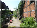
Public footpath through Rectory Farm, Crowle
The barn on the right is Grade II Listed.
Image: © Chris Allen
Taken: 25 Jun 2022
0.17 miles
5
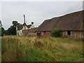
Old Farm buildings near Commandery Farm, Crowle
Image: © Jeff Gogarty
Taken: 2 Sep 2021
0.17 miles
6

Barn at Rectory Farm, Lower Crowle (2)
The footpath runs through the shed at the left of the image.
Image: © Jeff Gogarty
Taken: 10 Sep 2019
0.18 miles
8
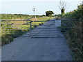
Access to the sewage works near Froxmere
Image: © Chris Allen
Taken: 28 Jun 2015
0.18 miles
9
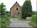
Barn at Rectory Farm, Lower Crowle (1)
Image: © Jeff Gogarty
Taken: 10 Sep 2019
0.18 miles
10
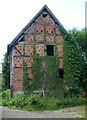
Barn about 50 yards south-west of Rectory Farmhouse, Crowle
Barn c1600 and extended mid-17th century. Timber framed with brick infill on a masonry plinth and having a tiled roof. Listed Grade II. Seen from a public footpath through the farm buildings.
Image: © Chris Allen
Taken: 25 Jun 2022
0.18 miles