
IMAGES TAKEN NEAR TO
Crowle, WORCESTER, WR7 4AH
Introduction
This page details the photographs taken nearby to WR7 4AH by members of the Geograph project.
The Geograph project started in 2005 with the aim of publishing, organising and preserving representative images for every square kilometre of Great Britain, Ireland and the Isle of Man.

There are currently over 7.5m images from over14,400 individuals and you can help contribute to the project by visiting https://www.geograph.org.uk
Image Map
Images are licensed for reuse under creativecommons.org/licenses/by-sa/2.0
Notes
- Clicking on the map will re-center to the selected point.
- The higher the marker number, the further away the image location is from the centre of the postcode.
Image Listing (26 Images Found)
Images are licensed for reuse under creativecommons.org/licenses/by-sa/2.0
Image
Details
Distance
1
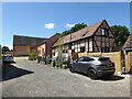
Stable about 20 yards north of the Mordaunts
The stables are the timber framed building closest to the camera and are Listed Grade II. Now converted to a dwelling. Built in the 17th century with mid-20th century alterations before conversion to a dwelling. Timber framed with brick infill and plain tiled roof. The transverse barn in the background is also Grade II Listed but the intervening red brick building is not.
Image: © Chris Allen
Taken: 25 Jun 2022
0.02 miles
2
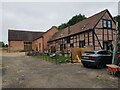
Barn Conversion at Commandery Farm, Crowle
Image: © Jeff Gogarty
Taken: 2 Sep 2021
0.02 miles
3
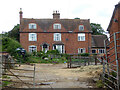
Commandry Farmhouse, Crowle
Built c1600 and remodelled mid-19th century. Part timber framed. Listed Grade II. This is a working farm.
Image: © Chris Allen
Taken: 25 Jun 2022
0.03 miles
4
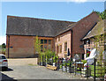
Barn about 15 yards north-west of the Mordaunts
Shown on the map as Foxley Barn, now converted to a dwelling and Listed Grade II. Built in the 17th century and extended and altered in the mid- to late-19th century. The perpendicularly orientated building on the right is not listed except for the stables on the extreme right that are separately Listed Grade II. This was taken from a public footpath and the image cropped out of a wider view.
Image: © Chris Allen
Taken: 25 Jun 2022
0.03 miles
5
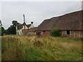
Old Farm buildings near Commandery Farm, Crowle
Image: © Jeff Gogarty
Taken: 2 Sep 2021
0.04 miles
6
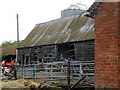
Barn about 10 yards north-east of Commandry Farmhouse, Crowle
A 17th century timber framed and weatherboarded barn with a corrugated metal roof. Listed Grade II. This remains a working farm.
Image: © Chris Allen
Taken: 25 Jun 2022
0.05 miles
7
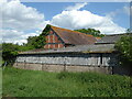
Granary, cart shed and stables about 30 yards west of Rectory Farmhouse, Crowle
Seen from a public footpath and partly obscured by more modern sheds. Built in the 17th century with mid-20th century alterations. timber framed with brick infill and a plain tiled roof. Listed Grade II.
Image: © Chris Allen
Taken: 25 Jun 2022
0.06 miles
9
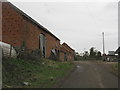
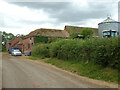
Commandery Farm's Barns
The farm's buildings extend in profusion on both sides of the lane east of Crowle.
Image: © Peter Whatley
Taken: 23 Mar 2010
0.06 miles
10
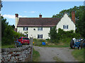
Rectory Farmhouse, Crowle
Photographed from the public footpath. This is a mid-19th century remodelling of a 17th century structure in painted brick with a tiled roof. Listed Grade II.
Image: © Chris Allen
Taken: 25 Jun 2022
0.07 miles