IMAGES TAKEN NEAR TO
Martley, WORCESTER, WR6 6QT
Introduction
This page details the photographs taken nearby to WR6 6QT by members of the Geograph project.
The Geograph project started in 2005 with the aim of publishing, organising and preserving representative images for every square kilometre of Great Britain, Ireland and the Isle of Man.

There are currently over 7.5m images from over14,400 individuals and you can help contribute to the project by visiting https://www.geograph.org.uk
Image Map
Images are licensed for reuse under creativecommons.org/licenses/by-sa/2.0
Notes
- Clicking on the map will re-center to the selected point.
- The higher the marker number, the further away the image location is from the centre of the postcode.
Image Listing (18 Images Found)
Images are licensed for reuse under creativecommons.org/licenses/by-sa/2.0
Image
Details
Distance
1
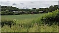
Hambridge Farm
Taken from the 6½ mile Martley circular walk, this farm is placed close to its namesake, and that is Ham Bridge.
Image: © Fabian Musto
Taken: 5 Jul 2021
0.14 miles
2
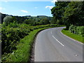
The B4204 road (Martley)
The 6½ mile Martley circular walk crosses the B4204 road from Tee Farm (east) to the River Teme (west).
Image: © Fabian Musto
Taken: 5 Jul 2021
0.14 miles
3
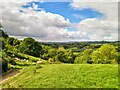
The Martley Circular Walk
Here is the 6½ mile Martley circular walk, which starts from St. Peter's parish church and heads to Rodge Hill, where the walk heads south to end at the same parish church. This section of the walk heads south towards the River Teme.
Image: © Fabian Musto
Taken: 5 Jul 2021
0.15 miles
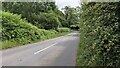
4
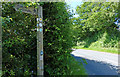
Public footpath marker along the B4204
Several paths pass through here, the Worcestershire Way, the Geopark Way, and the Martley Circular Walk.
Image: © Mat Fascione
Taken: 12 Jun 2014
0.15 miles
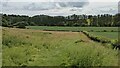
6
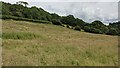
Field by the B4204 road (Martley)
Taken from the 6½ mile Martley circular walk, this field is placed north of the River Teme.
Image: © Fabian Musto
Taken: 5 Jul 2021
0.16 miles
7
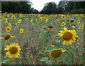
Field of sunflowers near Hambridge Farm
Image: © Mat Fascione
Taken: 24 Aug 2020
0.18 miles
8
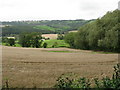
Battered wheat
This field should have been harvested already, but it's barely upright with more rain about to fall.
Image: © Peter Whatley
Taken: 11 Sep 2008
0.19 miles
10
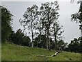
Birch trees by Tee Farm (Martley)
Here are several birch trees by Tee Farm and the B4204 road, taken from the 6½ mile Martley circular walk.
Image: © Fabian Musto
Taken: 5 Jul 2021
0.22 miles