IMAGES TAKEN NEAR TO
Ockeridge Lane, WORCESTER, WR6 6LY
Introduction
This page details the photographs taken nearby to Ockeridge Lane, WR6 6LY by members of the Geograph project.
The Geograph project started in 2005 with the aim of publishing, organising and preserving representative images for every square kilometre of Great Britain, Ireland and the Isle of Man.

There are currently over 7.5m images from over14,400 individuals and you can help contribute to the project by visiting https://www.geograph.org.uk
Image Map
Images are licensed for reuse under creativecommons.org/licenses/by-sa/2.0
Notes
- Clicking on the map will re-center to the selected point.
- The higher the marker number, the further away the image location is from the centre of the postcode.
Image Listing (13 Images Found)
Images are licensed for reuse under creativecommons.org/licenses/by-sa/2.0
Image
Details
Distance
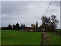
1
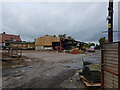
Rowley Farm, Okeridge Lane, near Holt Heath
Image: © Jeff Gogarty
Taken: 30 Oct 2020
0.03 miles
2
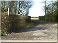
Footpath and field gate
Footpath and field gate off Ockeridge Lane near Rowley Farm.
Image: © Philip Halling
Taken: 7 Mar 2017
0.04 miles
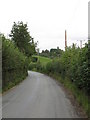
3
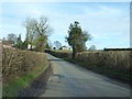
Ockeridge Lane
Ockeridge Lane approaching the A443 to the east of Holt Heath.
Image: © Philip Halling
Taken: 7 Mar 2017
0.12 miles
5
House on Ockeridge Lane from a field
This is the other side of the hedge to Image
Image: © Jeff Gogarty
Taken: 30 Oct 2020
0.13 miles
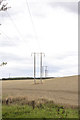
6
Ockeridge Lane near Rowe Farm's entrance
Image: © Peter Whatley
Taken: 11 Sep 2008
0.13 miles
7
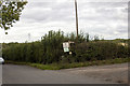
Rowe Farm
Entrance to Rowe farm with farm sign
Image: © P Gaskell
Taken: Unknown
0.18 miles
8
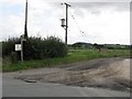
Track to Rowe Farm
Home to pedigree Holstein cattle, according to the sign.
Image: © Peter Whatley
Taken: 11 Sep 2008
0.19 miles
9
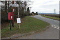
Turning for Wichenford on the A443 near Holt Heath
Image: © Philip Halling
Taken: 19 Mar 2006
0.21 miles
10
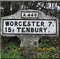
Old Milestone, A443, Witley Road, West of Hazeldene
The milestone is located opposite the bungalow 100m west of the junction for Ockeridge, in the hedge at the back of the wide verge, on the north side of road. Parish of Holt (Malvern Hills District). Metal plate attached to concrete post, Bradley post design, erected by the County Council in the 20th century.
Inscription reads:-
A443 / WORCESTER 7. / 15½ TENBURY. / C.C.W.
Milestone Society National ID: WO_WOGW07
Image: © David Beacham
Taken: 6 Aug 2014
0.23 miles