IMAGES TAKEN NEAR TO
Brockhampton, Bringsty, WORCESTER, WR6 5TD
Introduction
This page details the photographs taken nearby to WR6 5TD by members of the Geograph project.
The Geograph project started in 2005 with the aim of publishing, organising and preserving representative images for every square kilometre of Great Britain, Ireland and the Isle of Man.

There are currently over 7.5m images from over14,400 individuals and you can help contribute to the project by visiting https://www.geograph.org.uk
Image Map
Images are licensed for reuse under creativecommons.org/licenses/by-sa/2.0
Notes
- Clicking on the map will re-center to the selected point.
- The higher the marker number, the further away the image location is from the centre of the postcode.
Image Listing (12 Images Found)
Images are licensed for reuse under creativecommons.org/licenses/by-sa/2.0
Image
Details
Distance
1
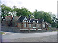
Bromyard Downs - Brockhampton Primary School
Opened on the 1st of June 1885. The original school opened with 7 children, it had one classroom, a hall and a house for the Head Teacher. The school has been improved over the years and now has seven classrooms.
Image: © Tony Bailey
Taken: 26 Apr 2007
0.02 miles
2
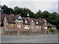
Brockhampton Primary School
Great location with open access to Bromyard Downs at the back.
Image: © Trevor Rickard
Taken: 11 Jul 2007
0.02 miles
6
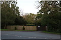
Caravan site entrance on the A44, Bringsty
Image: © David Howard
Taken: 11 May 2019
0.13 miles
8
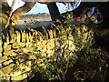
Dry stone wall on Bromyard Downs
There are not many free standing dry stone walls surviving in N E Herefordshire, and only fragments survive of this one which was built in the 19th century to separate the Downs from the Brockhampton Estate (this is in the background, part of Warren Farm). The wall ran from where Brockhampton School was later built up the hill to Warren Wood, and the stone used came from small quarries very near by.
Image: © CHARLES GORDON CLARK
Taken: 20 Mar 2014
0.21 miles
9
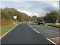
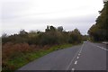
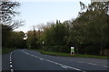
A44 at the turning for Malvern (B4220)
Image: © Peter Whatley
Taken: 25 Oct 2011
0.22 miles
10

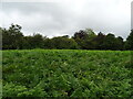
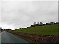
Bromyard Downs
An area of old common grazing below the A44. It is now turning to woodland with a traditional Herefordshire floor of brambles.
Image: © Richard Webb
Taken: 16 Feb 2019
0.23 miles