
IMAGES TAKEN NEAR TO
Bath Road, WORCESTER, WR5 3YB
Introduction
This page details the photographs taken nearby to Bath Road, WR5 3YB by members of the Geograph project.
The Geograph project started in 2005 with the aim of publishing, organising and preserving representative images for every square kilometre of Great Britain, Ireland and the Isle of Man.

There are currently over 7.5m images from over14,400 individuals and you can help contribute to the project by visiting https://www.geograph.org.uk
Image Map
Images are licensed for reuse under creativecommons.org/licenses/by-sa/2.0
Notes
- Clicking on the map will re-center to the selected point.
- The higher the marker number, the further away the image location is from the centre of the postcode.
Image Listing (153 Images Found)
Images are licensed for reuse under creativecommons.org/licenses/by-sa/2.0
Image
Details
Distance
1
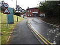
Spire South Bank Hospital
Spire South Bank Hospital, a private hospital on Bath Road in Worcester.
Image: © Philip Halling
Taken: 5 Mar 2016
0.03 miles
2
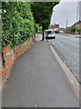
A38 Bath Road, Worcester
View looking south along Bath Road, Worcester.
Image: © V1ncenze
Taken: 27 Jul 2020
0.04 miles
3

Ordnance Survey Bench Mark
This mark is located on a boundary wall on the east side of Bath Road, Worcester. These marks were used by Ordnance Survey for mapping purposes.
Image: © V1ncenze
Taken: 27 Jul 2020
0.04 miles
4
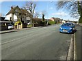
Bath Road in Worcester
Houses on Bath Road in Worcester. A little further along this road the ground falls away steeply to the left, so steep that what appears as the ground floor is in fact the first floor.
Image: © Philip Halling
Taken: 5 Mar 2016
0.04 miles
5
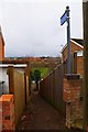
Footpath to Diglis Lane, Worcester
This footpath commences in Bath Road (part of the A38) and descends between houses and their gardens before ending at Diglis Lane.
Image: © P L Chadwick
Taken: 1 Mar 2015
0.05 miles
6
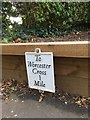
Replica Mileplate, A38, Bath Road, Worcester
The mileplate is attached to the low wooden wall in front of 142 Bath Road, opposite Southbank Hospital, on the west side of the road. One of six replica mileplates installed by the Worcester Group of the Milestone Society in 2018; original milestones were by Worcester Turnpike Trust.
Inscription reads:-
To / Worcester / Cross / 1 Mile
Milestone Society National ID: WO_WOTW01R
Image: © Jan Scrine
Taken: 6 Oct 2019
0.05 miles
7
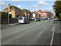
Bath Road, Worcester
The ground falls away steeply to the left, so steeply that what appears to be single storey dwellings are in fact the first floor of houses.
Image: © Philip Halling
Taken: 5 Mar 2016
0.06 miles
8
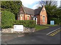
Lodge at South Bank
Lodge beside the entrance to Spire, South Bank Hospital on Bath Road in Worcester.
Image: © Philip Halling
Taken: 5 Mar 2016
0.06 miles
9
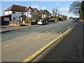
Bath Road in Worcester
Bath Road to the north of Greenway Drive in Worcester.
Image: © Philip Halling
Taken: 5 Mar 2016
0.06 miles
10
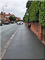
A38 Bath Road looking North
View looking north along the A38, Bath Road, Worcester.
Image: © V1ncenze
Taken: 27 Jul 2020
0.07 miles