
IMAGES TAKEN NEAR TO
Barbel Crescent, WORCESTER, WR5 3QU
Introduction
This page details the photographs taken nearby to Barbel Crescent, WR5 3QU by members of the Geograph project.
The Geograph project started in 2005 with the aim of publishing, organising and preserving representative images for every square kilometre of Great Britain, Ireland and the Isle of Man.

There are currently over 7.5m images from over14,400 individuals and you can help contribute to the project by visiting https://www.geograph.org.uk
Image Map
Images are licensed for reuse under creativecommons.org/licenses/by-sa/2.0
Notes
- Clicking on the map will re-center to the selected point.
- The higher the marker number, the further away the image location is from the centre of the postcode.
Image Listing (173 Images Found)
Images are licensed for reuse under creativecommons.org/licenses/by-sa/2.0
Image
Details
Distance
1
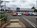
B&M and Lidl
B&M and Lidl beside the A38 on the southern edge of Worcester. This used to be a Homebase store.
Image: © Philip Halling
Taken: 7 Sep 2019
0.05 miles
2
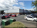
B & M and Aldi, Worcester
On the A38 near its junction with the A4440. B & M is nearest the camera and Aldi is furthest away. I have not been inside a supermarket since just before lockdown started in March 2020 (true as of 30th August 2020).
Image: © Chris Allen
Taken: 29 Aug 2020
0.06 miles
3
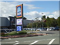
Entrance to stores from the Bath Road, Worcester
Aldi and B & M are clustered on the outskirts of Worcester close to the A4440 Worcester Bypass.
Image: © Chris Allen
Taken: 29 Aug 2020
0.07 miles
5
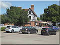
The Timberdine public house and restaurant
One of the Harvester chain of establishments and located at St Peter the Great, Worcester. This was the best lit view of it.
Image: © Chris Allen
Taken: 29 Aug 2020
0.08 miles
6
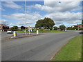
Roundabout on the Bath Road, Worcester
This is by the Timberdine at the junction with St Peter's Drive.
Image: © Chris Allen
Taken: 29 Aug 2020
0.08 miles
7
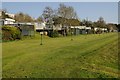
The Ketch Caravan Park
The Ketch Caravan Park overlooking the River Severn to the south of Worcester.
Image: © Philip Halling
Taken: 19 Apr 2018
0.09 miles
8
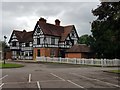
The Timberdine
A Harvester inn at Bath Rd, Broomhall Ln, Worcester.
Image: © Jeff Gogarty
Taken: 9 Jul 2020
0.09 miles
9
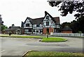
Harvester Timberdine (1), Bath Road, St. Peter's, Worcester
Located by the roundabout on the corner of Bath Road and St. Peter's Drive. One of Mitchells & Butlers Harvester chain of large pub/restaurants. The Timberdine in the name comes from the fact that the building was originally the farmhouse for Timberdine Farm. The timber framed building is Grade II listed and dates from the 16th century, with late 19th and late 20th century alterations and additions. Its present use dates from about 1985.
Image
Image: © P L Chadwick
Taken: 13 Aug 2021
0.09 miles
10
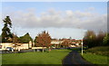
Bath road beside The Ketch
This walkway runs north beside the old main road south out of Worcester between the Ketch (an old roadside pub and viewpoint over the Severn flood plain) and The Timberdine (an ancient farmhouse now a pub and restaurant). The "shed" in the middle ground is a Homebase store behind which is new housing on the site of the old river fed oil storage depot.
Image: © Andrew Darge
Taken: 29 Dec 2007
0.10 miles