IMAGES TAKEN NEAR TO
Old Road South, WORCESTER, WR5 3NJ
Introduction
This page details the photographs taken nearby to Old Road South, WR5 3NJ by members of the Geograph project.
The Geograph project started in 2005 with the aim of publishing, organising and preserving representative images for every square kilometre of Great Britain, Ireland and the Isle of Man.

There are currently over 7.5m images from over14,400 individuals and you can help contribute to the project by visiting https://www.geograph.org.uk
Image Map
Images are licensed for reuse under creativecommons.org/licenses/by-sa/2.0
Notes
- Clicking on the map will re-center to the selected point.
- The higher the marker number, the further away the image location is from the centre of the postcode.
Image Listing (145 Images Found)
Images are licensed for reuse under creativecommons.org/licenses/by-sa/2.0
Image
Details
Distance
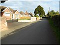
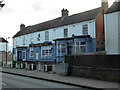
1
Farlie Close
A fairly recent development of bungalows.
Image: © Bill Boaden
Taken: 16 Nov 2019
0.04 miles
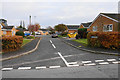
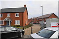
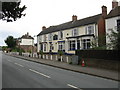
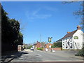
2
Houses on Old Road South, Kempsey
Recently built houses on Old Road South in Kempsey.
Image: © Philip Halling
Taken: 11 Oct 2016
0.09 miles
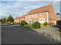
3
New housing on Lawnspool Drive
This development is only just finding its way onto maps.
Image: © Bill Boaden
Taken: 16 Nov 2019
0.14 miles
6
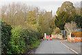
Squire's Walk
A road leading up to the parish church which has to cross a ford over Hatfield Brook. The ford has been closed due to the level of the water.
Image: © Bill Boaden
Taken: 16 Nov 2019
0.15 miles
7
Kempsey: Flood protection bund
After numerous flood events the village of Kempsey finally got its protection from the River Severn with the construction of this bund, completed in 2012. This is the south-eastern end of the bund showing how it merges into the naturally rising agricultural land beyond. The function of the large wooden posts on both the upstream and downstream sides is unknown. Perhaps they are boundary markers indicating the extents of the land taken out of the original field.
Image: © Nigel Cox
Taken: 26 Oct 2013
0.15 miles
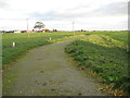
10
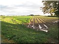
Kempsey: River Severn floodplain
These fields will get a periodic inundation of floodwater from the neraby River Severn.
Image: © Nigel Cox
Taken: 26 Oct 2013
0.16 miles