
IMAGES TAKEN NEAR TO
St. Marks Court, Bath Road, WORCESTER, WR5 3EG
Introduction
This page details the photographs taken nearby to St. Marks Court, Bath Road, WR5 3EG by members of the Geograph project.
The Geograph project started in 2005 with the aim of publishing, organising and preserving representative images for every square kilometre of Great Britain, Ireland and the Isle of Man.

There are currently over 7.5m images from over14,400 individuals and you can help contribute to the project by visiting https://www.geograph.org.uk
Image Map
Images are licensed for reuse under creativecommons.org/licenses/by-sa/2.0
Notes
- Clicking on the map will re-center to the selected point.
- The higher the marker number, the further away the image location is from the centre of the postcode.
Image Listing (44 Images Found)
Images are licensed for reuse under creativecommons.org/licenses/by-sa/2.0
Image
Details
Distance
1
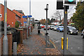
Cycle route crossing Bath Road
Cycle route 442 crosses here on the stretch between Worcester and Pershore.
Image: © Bill Boaden
Taken: 16 Nov 2019
0.01 miles
2
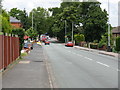
Roadworks ahead
On Bath Road (A38): taken from the junction with Ransom Avenue.
Image: © Peter Whatley
Taken: 24 Jun 2008
0.01 miles
3
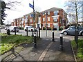
Housing apartments, Bath Road
This development of apartments was built just over 10 years ago on the site of a former car sales on Bath Road.
Image: © Philip Halling
Taken: 5 Mar 2016
0.01 miles
4
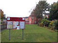
St Mark's in the Cherry Orchard
ST MARK’S in the Cherry Orchard is the delightfully named church in a southern suburb of Worcester.Its foundation stone was officially laid on June 21, 1902. St Mark’s began life as only “a mission church” – an offshoot or outpost of the large-scale Parish of St Peter’s. For more than three decades, St Mark’s remained a mission church under the wing of St Peter’s. But a major milestone came in 1936, when it was designated “a conventional district”, making it a completely independent church with its own incumbent and own parochial church council. The natural progression from this came in 1955 with the official creation of the Parish of St Mark’s in the Cherry Orchard (Family Search Parish History)
Image: © Eirian Evans
Taken: 18 Oct 2014
0.02 miles
5
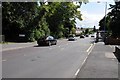
Bath Road, Worcester
View to the south along the A38, Bath Road in Worcester.
Image: © Philip Halling
Taken: 22 Aug 2014
0.02 miles
7
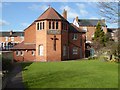
St Mark's church
St Mark's church on Bath Road in Worcester.
Image: © Philip Halling
Taken: 5 Mar 2016
0.04 miles
8
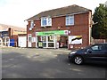
Co-operative store
A Co-operative store on Bath Road in Worcester.
Image: © Philip Halling
Taken: 5 Mar 2016
0.05 miles
9
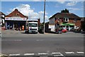
Businesses on Bath Road
A Coop supermarket and a tool hire business on Bath Road in Worcester.
Image: © Philip Halling
Taken: 22 Aug 2014
0.05 miles
10
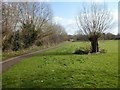
Footpath beside Duck Brook
Footpath through a recreation area beside Duck Brook off Bath Road in Worcester. The brook is subject to some flooding.
Image: © Philip Halling
Taken: 5 Mar 2016
0.05 miles